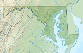
Wills Mountain State Park
| Wills Mountain State Park | |
|---|---|
 Cumberland Narrows seen from the Wills Mountain side of the gap | |
| Location | Cumberland, Maryland, United States |
| Coordinates | 39°40′07″N 78°46′54″W / 39.66861°N 78.78167°W[1] |
| Area | 357 acres (144 ha)[2] |
| Elevation | 804 ft (245 m)[1] |
| Designation | Maryland state park |
| Established | 1998 |
| Administrator | Maryland Department of Natural Resources |
Wills Mountain State Park is an undeveloped public recreation area on Wills Mountain overlooking the Cumberland Narrows in Allegany County, Maryland. The state park occupies 357 acres (144 ha) on the northwest edge of the City of Cumberland. It is under the control of the Maryland Department of Natural Resources.
History[edit]
From 1899 until 1930, Wills Mountain was the site of the Wills Mountain Inn, a mansion featuring 46 bedrooms with private baths and a grand ballroom that was initially used as a fraternal clubhouse and informal country club.[3] In 1902, the property was sold to Dr. Henry Fry for conversion to a sanatorium.[4] The property burned down in 1930.[3]
In 1952, the Maryland State Planning Commission encouraged the state to create an historic preserve on Wills Mountain through the purchase of 400 acres, the improvement of a private road that ascended to the summit, and development of picnicking and sightseeing facilities to take advantage of the natural beauty of the overlook.[5] The park was created in 1998 when the state purchased 350 acres from Carl G. Valentine for $160,000, and George and Joan Henderson donated another 51 acres.[6] The 2009 Maryland Land Preservation, Parks and Recreation Plan described the parcel as "virtually inaccessible" and "sensitive" with "no uses ... official or informal."[7] The state began purchasing adjoining parcels in 2017 with the intention of creating public access to the site.[6][8]
References[edit]
- ^ a b "Wills Mountain State Park". Geographic Names Information System. United States Geological Survey, United States Department of the Interior.
- ^ "DNR Lands Acreage" (PDF). Maryland Department of Natural Resources. Retrieved December 7, 2019.
- ^ a b Feldstein, Albert L. (2006). Allegany County. Postcard History Series. Charleston, S.C.: Arcadia Publishing. p. 73. ISBN 978-1-4396-1760-1. Retrieved November 15, 2016.
- ^ "Medical News". The Journal of the American Medical Association. Chicago: American Medical Association Press: 262. 1902. Retrieved November 15, 2016.
- ^ "Master Plan: Maryland State Parks and Recreation Areas". Maryland State Planning Commission. March 1952. pp. 48–49. Retrieved June 8, 2016.
- ^ a b Sawyers, Michael A. (July 27, 2017). "Maryland's secret park expands, but still no public access". U.S. News & World Report. Associated Press. Retrieved November 6, 2017.
- ^ "Maryland Land Preservation, Parks & Recreation Plan 2009" (PDF). Maryland DNR. Archived from the original (PDF) on March 6, 2010. Retrieved December 20, 2013.
- ^ Sawyers, Michael A. (August 23, 2018). "Wills Mountain State Park will have first public access point". Cumberland Times-News. Retrieved December 7, 2019.
External links[edit]
- Wills Mountain State Park Protected Planet


