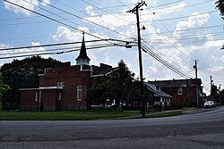
New Liberty Historic District
New Liberty Historic District | |
 | |
| Location | Kentucky Route 227, roughly between KY 978 and KY 36, New Liberty, Kentucky |
|---|---|
| Coordinates | 38°36′52″N 84°54′27″W / 38.61444°N 84.90750°W |
| Area | 29.5 acres (11.9 ha) |
| Built | 1815 |
| Architectural style | Georgian, Early Republic |
| NRHP reference No. | 00001601[1] |
| Added to NRHP | January 4, 2001 |
The New Liberty Historic District in New Liberty, Kentucky is a 29.5 acres (11.9 ha) historic district which was listed on the National Register of Historic Places in 2001.[1] It is located along Kentucky Route 227, roughly between KY 978 and KY 36.
The district includes 64 contributing buildings and five contributing sites. Development in the district dates from 1815.[1]
Selected properties include:
- Garvey-Moody Residence (1880), a two-and-a-half-story brick house, mostly unchanged since originally built
- New Liberty Post Office (1875), a commercial building, mostly unchanged since originally built[2]
See also[edit]
- Jacob Hunter House (New Liberty, Kentucky)
- National Register of Historic Places listings in Owen County, Kentucky
References[edit]
- ^ a b c "National Register Information System". National Register of Historic Places. National Park Service. July 9, 2010.
- ^ Donna G. Logsdon (July 28, 2000). "National Register of Historic Places Registration: New Liberty Historic District". National Park Service. Retrieved January 15, 2018. With 35 photos.


