
Eagle City, Oklahoma
Eagle City | |
|---|---|
 Eagle City Location within the state of Oklahoma  Eagle City Eagle City (the United States) | |
| Coordinates: 35°56′02″N 98°35′24″W / 35.93389°N 98.59000°W | |
| Country | United States |
| State | Oklahoma |
| County | Blaine |
| Area | |
| • Total | 0.67 sq mi (1.74 km2) |
| • Land | 0.67 sq mi (1.74 km2) |
| • Water | 0.00 sq mi (0.00 km2) |
| Elevation | 1,706 ft (520 m) |
| Population (2020) | |
| • Total | 40 |
| • Density | 59.44/sq mi (22.94/km2) |
| Time zone | UTC-6 (Central (CST)) |
| • Summer (DST) | UTC-5 (CDT) |
| ZIP codes | 73658 |
| FIPS code | 40-22300 |
| GNIS feature ID | 2805314[2] |
| Website | www |
Eagle City is a small rural community located along and west of State Highway 58 in western Blaine County, Oklahoma, United States.[2] Established on the Frisco Line before statehood, the post office which opened July 26, 1902 was named Dillon. The name was changed to Eagle City September 4, 1909.[3] The ZIP Code is 73658. The nearest post office is now in Oakwood.[4]
Demographics[edit]
| Census | Pop. | Note | %± |
|---|---|---|---|
| 2020 | 40 | — | |
| U.S. Decennial Census[5] | |||
References[edit]
- ^ "ArcGIS REST Services Directory". United States Census Bureau. Retrieved September 20, 2022.
- ^ a b c U.S. Geological Survey Geographic Names Information System: Eagle City, Oklahoma
- ^ Shirk, George H. Oklahoma Place Names, Norman, Oklahoma: University of Oklahoma Press, 1965, p.68.
- ^ "Find USPS Locations-Eagle City, Oklahoma". U.S. Postal Service. Retrieved March 18, 2024.
- ^ "Census of Population and Housing". Census.gov. Retrieved June 4, 2016.
External links[edit]
- Eagle City at GhostTowns.com
Municipalities and communities of Blaine County, Oklahoma, United States | ||
|---|---|---|
| Cities | 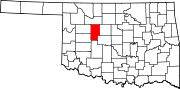 | |
| Towns | ||
| CDPs | ||
| Other community | ||
| Ghost towns | ||
| Footnotes | ‡This populated place also has portions in an adjacent county or counties | |
This Oklahoma state location article is a stub. You can help Wikipedia by expanding it. |