Remšnik
Remšnik | |
|---|---|
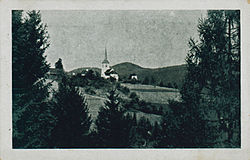
 1920s postcard of Remšnik | |
| Coordinates: 46°38′32.95″N 15°17′10.4″E / 46.6424861°N 15.286222°E | |
| Country | |
| Traditional region | Styria |
| Statistical region | Carinthia |
| Municipality | Radlje ob Dravi |
| Area | |
| • Total | 5.93 km2 (2.29 sq mi) |
| Elevation | 851.2 m (2,792.7 ft) |
| Population (2002) | |
| • Total | 99 |
| [1] | |
Remšnik (pronounced [ˈɾeːmʃnik]) is a dispersed settlement in the hills northeast of Radlje ob Dravi in Slovenia.[2]
The parish church in the settlement is dedicated to Saint George and belongs to the Roman Catholic Archdiocese of Maribor. It was built on the foundations of a late Gothic church dating to 1532 after a fire in 1863 completely destroyed the original building. It is a single-nave church with a belfry on its western facade.[3]
References[edit]
External links[edit]
 Media related to Remšnik at Wikimedia Commons
- Remšnik on Geopedia


