
Dolany (Klatovy District)
Dolany | |
|---|---|
 Centre of Dolany | |
_CoA.png) Coat of arms | |
 Dolany Location in the Czech Republic | |
| Coordinates: 49°26′36″N 13°14′53″E / 49.44333°N 13.24806°E | |
| Country | |
| Region | Plzeň |
| District | Klatovy |
| First mentioned | 1232 |
| Area | |
| • Total | 25.29 km2 (9.76 sq mi) |
| Elevation | 387 m (1,270 ft) |
| Population (2023-01-01)[1] | |
| • Total | 995 |
| • Density | 39/km2 (100/sq mi) |
| Time zone | UTC+1 (CET) |
| • Summer (DST) | UTC+2 (CEST) |
| Postal code | 339 01 |
| Website | www |
Dolany is a municipality and village in Klatovy District in the Plzeň Region of the Czech Republic. It has about 1,000 inhabitants.
Dolany lies approximately 7 kilometres (4 mi) north-west of Klatovy, 35 km (22 mi) south of Plzeň, and 111 km (69 mi) south-west of Prague.
Administrative parts[edit]
The villages of Andělice, Balkovy, Komošín, Malechov, Řakom, Sekrýt, Svrčovec and Výrov are administrative parts of Dolany.
Demographics[edit]
| Year | Pop. | ±% |
|---|---|---|
| 1869 | 1,714 | — |
| 1880 | 1,753 | +2.3% |
| 1890 | 1,725 | −1.6% |
| 1900 | 1,701 | −1.4% |
| 1910 | 1,761 | +3.5% |
| 1921 | 1,746 | −0.9% |
| 1930 | 1,577 | −9.7% |
| 1950 | 1,159 | −26.5% |
| 1961 | 1,191 | +2.8% |
| 1970 | 1,000 | −16.0% |
| 1980 | 882 | −11.8% |
| 1991 | 764 | −13.4% |
| 2001 | 730 | −4.5% |
| 2011 | 814 | +11.5% |
| 2021 | 923 | +13.4% |
| Source: Censuses[2][3] | ||
Notable people[edit]
- Franz von Pitha (1810–1875), Austrian surgeon
Gallery[edit]
-
 Church of Saints Peter and Paul
 -
 Fortress ruin in Dolany
 -
 Chapel of Saint Anne in Svrčovec
 -
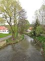 Poleňka stream
,_kostel_sv._Petra_a_Pavla.jpg)
,_tvrz_V.jpg)

,_Pole%C5%88ka.jpg)
References[edit]
- ^ "Population of Municipalities – 1 January 2023". Czech Statistical Office. 2023-05-23.
- ^ "Historický lexikon obcí České republiky 1869–2011 – Okres Klatovy" (in Czech). Czech Statistical Office. 2015-12-21. pp. 5–6.
- ^ "Population Census 2021: Population by sex". Public Database. Czech Statistical Office. 2021-03-27.
External links[edit]
Wikimedia Commons has media related to Dolany (Klatovy District).
| Authority control databases: National |
|---|
This Plzeň Region location article is a stub. You can help Wikipedia by expanding it. |