
Urbana, Arkansas
Urbana, Arkansas | |
|---|---|
 Urbana, Arkansas  Urbana, Arkansas | |
| Coordinates: 33°09′34″N 92°26′46″W / 33.15944°N 92.44611°W | |
| Country | United States |
| State | Arkansas |
| County | Union |
| Elevation | 154 ft (47 m) |
| Population (2020) | |
| • Total | 177 |
| Time zone | UTC-6 (Central (CST)) |
| • Summer (DST) | UTC-5 (CDT) |
| ZIP code | 71768 |
| Area code | 870 |
| GNIS feature ID | 55863[1] |
Urbana is an unincorporated community and census-designated place (CDP) in Union County, Arkansas, United States. Urbana is 13 miles (21 km) east-southeast of El Dorado. Urbana has a post office with ZIP code 71768.[2] It was first listed as a CDP in the 2020 census with a population of 177.[3]
Education[edit]
It is in the El Dorado School District.[4][5] The district operates El Dorado High School.
In 1978 the Lawson and Urbana school districts merged into the El Dorado district.[6]
Demographics[edit]
| Census | Pop. | Note | %± |
|---|---|---|---|
| 2020 | 177 | — | |
| U.S. Decennial Census[7] 2020[8] | |||
2020 census[edit]
| Race / Ethnicity | Pop 2020[8] | % 2020 |
|---|---|---|
| White alone (NH) | 136 | 76.84% |
| Black or African American alone (NH) | 9 | 5.08% |
| Native American or Alaska Native alone (NH) | 0 | 0.00% |
| Asian alone (NH) | 1 | 0.56% |
| Pacific Islander alone (NH) | 0 | 0.00% |
| Some Other Race alone (NH) | 0 | 0.00% |
| Mixed Race/Multi-Racial (NH) | 2 | 1.13% |
| Hispanic or Latino (any race) | 29 | 16.38% |
| Total | 177 | 100.00% |
Notable people[edit]
- Gertrude Jeannette (1914-2018), actress, was born in Urbana.[9]
References[edit]
- ^ U.S. Geological Survey Geographic Names Information System: Urbana, Arkansas
- ^ ZIP Code Lookup
- ^ "Urbana CDP, Arkansas". United States Census Bureau. Retrieved April 7, 2022.
- ^ "SCHOOL DISTRICT REFERENCE MAP (2010 CENSUS): Union County, AR." U.S. Census Bureau. Retrieved on February 27, 2021. Compare to highway map for unincorporated areas.
- ^ "General Highway Map Arkansas County, Arkansas" (PDF). Arkansas Department of Transportation. Archived from the original (PDF) on March 13, 2012. Retrieved February 25, 2021. - See Lawson and Urbana on the map.
- ^ Goatcher, Truett (January 1999). "School District Consolidation Will Save Millions of Dollars: Fact of Myth?" (PDF). Arkansas Association of Educational Administrators. p. 16 (PDF p. 16/27).
- ^ "Decennial Census of Population and Housing by Decades". US Census Bureau.
- ^ a b "P2 HISPANIC OR LATINO, AND NOT HISPANIC OR LATINO BY RACE – 2020: DEC Redistricting Data (PL 94-171) – Urbana CDP, Arkansas". United States Census Bureau.
- ^ Encyclopedia of Arkansas-Gertrude Jeannette
Municipalities and communities of Union County, Arkansas, United States | ||
|---|---|---|
| Cities | 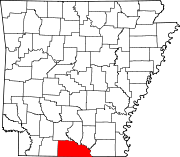 | |
| Town | ||
| CDPs | ||
| Other unincorporated communities | ||
This article about a location in Union County, Arkansas is a stub. You can help Wikipedia by expanding it. |