
Peral-Kannur
This article needs additional citations for verification. (October 2021) |
Kannur | |
|---|---|
Village | |
 The Kamuku bridge behind the Dargah | |
 Kannur Location in Kerala  Kannur Kannur (India) | |
| Coordinates: 12°34′12″N 74°58′51″E / 12.569968°N 74.980788°E | |
| Country | |
| State | Kerala |
| District | Kasaragod |
| Taluk | Manjeshwaram |
| Government | |
| • Body | Puthige Grama Panchayat |
| Elevation | 20 m (70 ft) |
| Population | |
| • Total | 2,421 |
| Languages | |
| • Official | Malayalam, English |
| Time zone | UTC+5:30 (IST) |
| PIN | 671321 |
| Telephone code | 91–4998 |
| ISO 3166 code | IN-KL |
| Vehicle registration | KL-14 |
Kannur is a village located in the Puthige panchayath, in Kasaragod district of the Indian state of Kerala. Kannur is home to the Ananthapura Lake Temple (12°35′03″N 74°58′55″E / 12.584209°N 74.981992°E), a Hindu temple located in the middle of a lake.
Peral-Kannur and Kannur[edit]
Peral-Kannur is a small village under the administration of Puthige panchayath in Kasaragod district. Kannur is a city and headquarters of the Kannur district some 106 kilometers south.
Demographics[edit]
As of 2011 Census, Kannur village had total population of 2,421 where 1,183 are males and 1,238 are females. Kannur village spreads over 6.86 km2 (2.65 sq mi) with 445 families residing in it. Population in the age group 0-6 was 284 among which 147 are males and 137 are females. Kannur had overall literacy of 90% where male literacy stands at 94.1% and female literacy was 86.1%.[1]
Landmarks[edit]
Peral-Kannur can be accessed from Madhur-Seethangoli road. The village school is located in this junction. The village Dargah and the watersfall can be accessed from this junction.[citation needed]
Geography and climate[edit]
Kannur lies along the Konkan coast, a rugged section of the western coastline of India on the Laccadive Sea, and is bounded on the west by the Mogral River (12°34′09″N 74°58′36″E / 12.569177°N 74.976759°E) and on the east by the KINFRA Industrial Park (12°34′27″N 74°59′51″E / 12.574099°N 74.997412°E). The village has heavy rainfalls during the monsoons season. The coastal area of Kannur is very rich in natural resources including rainforests and backwaters. The village has a tropical climate, and summer and winter months experience similar temperate conditions, with average temperatures ranging from 24 to 33 °C (75 to 91 °F).
Image gallery[edit]
-
 Kamuku bridge
 -
 Lunar landscape
 -
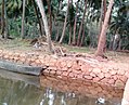 The 'thodi'
 -
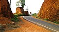
 Sulthan Road


References[edit]
- ^ Kerala, Directorate of Census Operations. District Census Handbook, Kasaragod (PDF). Thiruvananthapuram: Directorateof Census Operations,Kerala. p. 80,81. Retrieved 14 July 2020.
This article related to a location in Kasaragod district, Kerala, India is a stub. You can help Wikipedia by expanding it. |