Klinge
Klinge
Klinka | |
|---|---|
Gemeindeteil of Wiesengrund | |
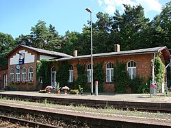
 Railway station | |
| Coordinates: 51°44′36″N 14°31′08″E / 51.74333°N 14.51889°E | |
| Country | Germany |
| State | Brandenburg |
| District | Spree-Neiße |
| Municipality | Wiesengrund |
| Time zone | UTC+01:00 (CET) |
| • Summer (DST) | UTC+02:00 (CEST) |
Klinge (Lower Sorbian: Klinka) is a village in the Lower Lusatia region,[1] east of the city of Cottbus in Brandenburg. It is a part (Gemeindeteil) of the municipality of Wiesengrund.[2]
In 1880, the village had a population of 376, almost exclusively Sorbian by ethnicity.[1]
Transport[edit]
The Klinge station is served once an hour in each direction by the RB46 train travelling between Cottbus and Forst.
References[edit]
External links[edit]


