
Nonda, Queensland

Nonda is a rural town in the locality of Maxwelton in the Shire of Richmond, Queensland, Australia.[1]
Geography[edit]
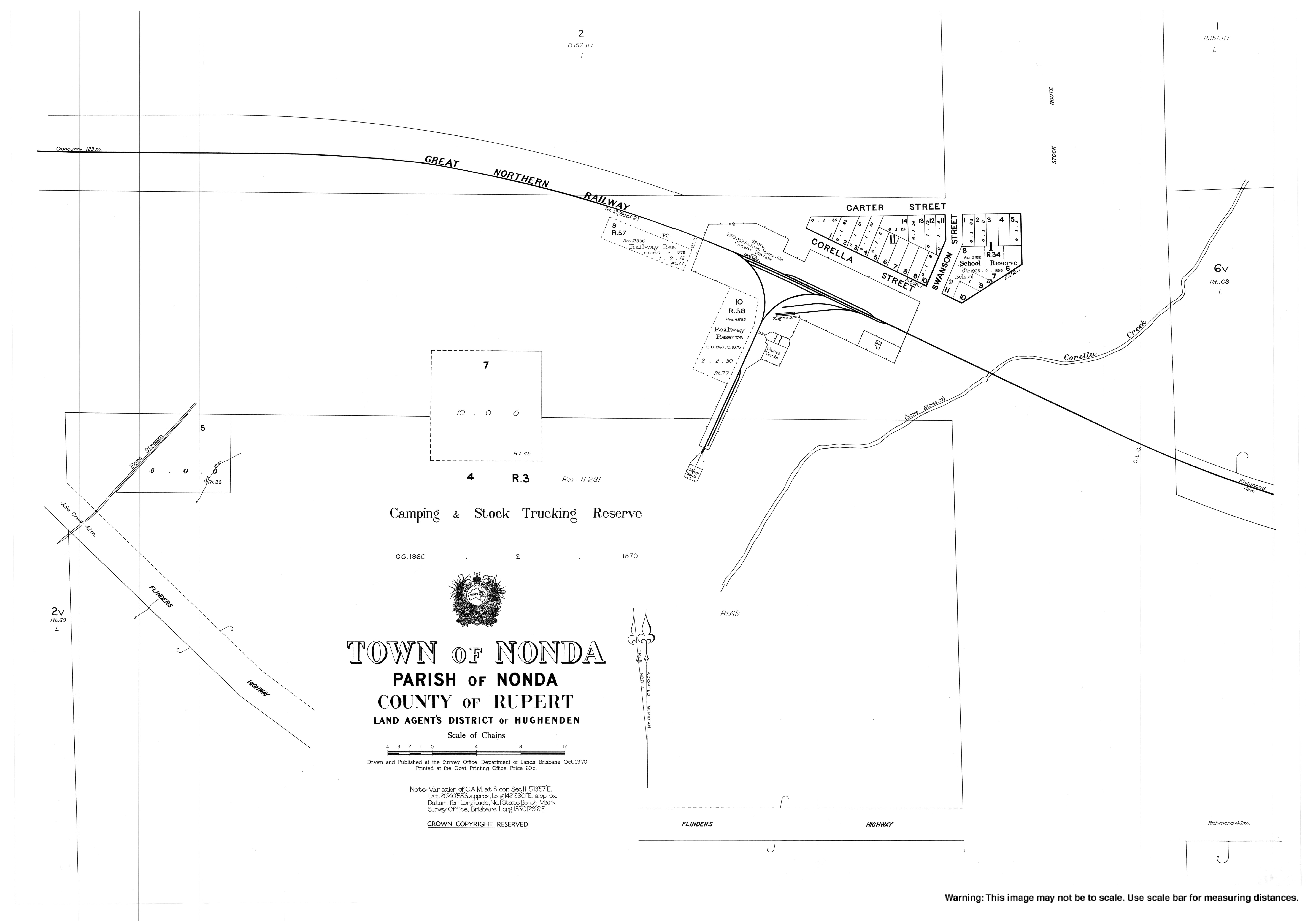
Nonda railway station (20°40′51″S 142°28′56″E / 20.6808°S 142.4821°E) is on the Great Northern Railway from Townsville to Mount Isa.[2][3]
History[edit]
The town of Nonda appears on a 1907 survey plan. The name Nonda is an Aboriginal word meaning the "plum" tree, Parinari nonda.[1]
Nonda State School opened on 14 April 1925 and closed on 25 July 1975.[4] It was in Corella Street (20°40′53″S 142°29′09″E / 20.6813°S 142.4857°E).[5]
References[edit]
- ^ a b "Nonda – town in Shire of Richmond (entry 24466)". Queensland Place Names. Queensland Government. Retrieved 28 December 2020.
- ^ "Railway stations and sidings - Queensland". Queensland Open Data. Queensland Government. 2 October 2020. Archived from the original on 5 October 2020. Retrieved 5 October 2020.
- ^ "Nonda – population centre in the Shire of Richmond (entry 24468)". Queensland Place Names. Queensland Government. Retrieved 24 January 2021.
- ^ Queensland Family History Society (2010), Queensland schools past and present (Version 1.01 ed.), Queensland Family History Society, ISBN 978-1-921171-26-0
- ^ "Town map of Nonda" (Map). Queensland Government. 1970. Retrieved 30 December 2021.