
Airville, Texas
Airville, Texas | |
|---|---|
 Airville  Airville | |
| Coordinates: 31°04′38″N 97°09′49″W / 31.07722°N 97.16361°W | |
| Country | United States |
| State | Texas |
| County | Bell |
| Elevation | 538 ft (164 m) |
| Time zone | UTC-6 (Central (CST)) |
| • Summer (DST) | UTC-5 (CDT) |
| Area code | 254 |
| GNIS feature ID | 1379327[1] |
Airville is an unincorporated community in Bell County, in the U.S. state of Texas.[1] According to the Handbook of Texas, the community had a population of 10 in 2000. It is located within the Killeen-Temple-Fort Hood metropolitan area.
History[edit]
Airville had three businesses in 1931 with only one business and several scattered houses in 1944. Ten people lived in those scattered homes from 1964 through 2000.[2]
Geography[edit]
Airville is located at the intersection of Farm to Market Roads 437 and 2904, 11 mi (18 km) east of Temple in northeastern Bell County.[2]
Education[edit]
Airville had its own school in 1944.[2] Today, the community is served by the Rosebud-Lott Independent School District.
References[edit]
- ^ a b U.S. Geological Survey Geographic Names Information System: Airville, Texas
- ^ a b c Odintz, Mark. "Airville, TX". tshaonline.org. Retrieved July 14, 2022.
Municipalities and communities of Bell County, Texas, United States | ||
|---|---|---|
| Cities | 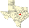 | |
| Towns | ||
| Village | ||
| CDPs | ||
| Other communities | ||
| Ghost town | ||
| Footnotes | ‡This populated place also has portions in an adjacent county or counties | |
 | This article about a location in Bell County, Texas is a stub. You can help Wikipedia by expanding it. |