Ciocănești, Dâmbovița
Ciocănești | |
|---|---|
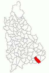
 Location in Dâmbovița County | |
| Coordinates: 44°36′N 25°51′E / 44.600°N 25.850°E | |
| Country | Romania |
| County | Dâmbovița |
| Government | |
| • Mayor (2020–2024) | Ion-Ciprian Nilă (PNL) |
| Area | 45.73 km2 (17.66 sq mi) |
| Population (2021-12-01)[1] | 5,286 |
| • Density | 120/km2 (300/sq mi) |
| Time zone | EET/EEST (UTC+2/+3) |
| Postal code | 137090 |
| Vehicle reg. | DB |
| Website | primariaciocanestidb |
Ciocănești is a commune in Dâmbovița County, Muntenia, Romania. It is composed of five villages: Ciocănești, Crețu, Decindea, Urziceanca, and Vizurești.
The commune lies in the middle of the Wallachian Plain, on the right bank of the Colentina River. It is located in the southeastern part of the county, on the border with Ilfov County, 30 km (19 mi) from downtown Bucharest, and 55 km (34 mi) from the county seat, Târgoviște.
Natives[edit]
- Alexandrina Cantacuzino (1876–1944), political activist, philanthropist, and diplomat
- Alexandru Cantacuzino (1901–1939), lawyer and politician


