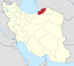
Golidagh Rural District
Golidagh Rural District
Persian: دهستان گلي داغ | |
|---|---|
| Coordinates: 37°39′11″N 55°58′47″E / 37.65306°N 55.97972°E[1] | |
| Country | Iran |
| Province | Golestan |
| County | Maraveh Tappeh |
| District | Golidagh |
| Capital | Golidagh |
| Population (2016)[2] | |
| • Total | 16,687 |
| Time zone | UTC+3:30 (IRST) |
Golidagh Rural District (Persian: دهستان گلي داغ) is in Golidagh District of Maraveh Tappeh County, Golestan province, Iran.[3] It is administered from the city of Golidagh.[4]
At the National Census of 2006, its population (as a part of the former Maraveh Tappeh District of Kalaleh County) was 16,506 in 3,188 households.[5] There were 15,643 inhabitants in 3,830 households at the following census of 2011,[6] by which time the district had been separated from the county in the establishment of Maraveh Tappeh County.[3] At the most recent census of 2016, the population of the rural district was 16,687 in 4,520 households. The most populous of its 26 villages was Yan Bolagh, with 2,183 people.[2]
References[edit]
- ^ OpenStreetMap contributors (14 October 2023). "Golidagh Rural District (Maraveh Tappeh County)" (Map). OpenStreetMap. Retrieved 14 October 2023.
- ^ a b "Census of the Islamic Republic of Iran, 1395 (2016)". AMAR (in Persian). The Statistical Center of Iran. p. 27. Archived from the original (Excel) on 29 March 2019. Retrieved 19 December 2022.
- ^ a b Davodi, Parviz (18 September 2016). "Letter of approval regarding the reforms of country divisions in Golestan province". Research Center of the System of Laws of the Islamic Council of the Farabi Library (in Persian). Ministry of Interior, Political-Defense Commission. Archived from the original on 23 November 2013. Retrieved 19 November 2023.
- ^ Mousavi, Mirhossein (18 May 1366). "Creation and establishment of 23 rural districts including villages, farms and places in Gonbad- Kavus County under Mazandaran province". Research Center of the System of Laws of the Islamic Council of the Farabi Library of Mobile Users (in Persian). Ministry of Interior, Board of Ministers. Archived from the original on 25 December 2013. Retrieved 19 November 2023.
- ^ "Census of the Islamic Republic of Iran, 1385 (2006)". AMAR (in Persian). The Statistical Center of Iran. p. 27. Archived from the original (Excel) on 20 September 2011. Retrieved 25 September 2022.
- ^ "Census of the Islamic Republic of Iran, 1390 (2011)". Syracuse University (in Persian). The Statistical Center of Iran. p. 27. Archived from the original (Excel) on 17 January 2023. Retrieved 19 December 2022.


