
Brunnthal
Brunnthal | |
|---|---|
 Saint Nicholas Church | |
 Coat of arms | |
Location of Brunnthal within Munich district 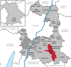 | |
 Brunnthal  Brunnthal | |
| Coordinates: 48°1′N 11°41′E / 48.017°N 11.683°E | |
| Country | Germany |
| State | Bavaria |
| Admin. region | Oberbayern |
| District | Munich |
| Government | |
| • Mayor (2020–26) | Stefan Kern[1] (CSU) |
| Area | |
| • Total | 26.92 km2 (10.39 sq mi) |
| Elevation | 592 m (1,942 ft) |
| Population (2022-12-31)[2] | |
| • Total | 5,580 |
| • Density | 210/km2 (540/sq mi) |
| Time zone | UTC+01:00 (CET) |
| • Summer (DST) | UTC+02:00 (CEST) |
| Postal codes | 85649 |
| Dialling codes | 08102, 08104 |
| Vehicle registration | M |
| Website | www.brunnthal.de |
Brunnthal is a municipality in the district of Munich in Bavaria in Germany.
References[edit]
- ^ Liste der ersten Bürgermeister/Oberbürgermeister in kreisangehörigen Gemeinden, Bayerisches Landesamt für Statistik, 15 July 2021.
- ^ Genesis Online-Datenbank des Bayerischen Landesamtes für Statistik Tabelle 12411-003r Fortschreibung des Bevölkerungsstandes: Gemeinden, Stichtag (Einwohnerzahlen auf Grundlage des Zensus 2011) (Hilfe dazu).
| International | |
|---|---|
| National | |
| Geographic | |
This Munich district location article is a stub. You can help Wikipedia by expanding it. |