
Harper's Grove – Lord's Grove
| Site of Special Scientific Interest | |
 Upper Beaulieu Farm and Lord's Grove | |
 Location within Monmouthshire | |
| Location | Monmouthshire |
|---|---|
| Grid reference | SO528113 |
| Coordinates | 51°47′55″N 2°41′05″W / 51.7987°N 2.6848°W |
| Interest | Biological |
| Area | 22.2 hectares (0.222 km2; 0.0857 sq mi) |
| Notification | 1981 |
Harper's Grove – Lord's Grove is a Site of Special Scientific Interest (SSSI), noted for its biological characteristics, in Monmouthshire, south east Wales.[1]
Geography[edit]
The 22.2-hectare (55-acre) SSSI, notified in 1981, is located within the community of Monmouth, being 1.5 miles (2.4 km) south-west of the town of the same name.[2][3]
Gallery[edit]
-
 Entrance to Harper's Grove from Kymin Road
 -
 Rocks within Harper's Grove
 -
 Flora of Harper's Grove
 -
 Footpath within Harper's Grove
 -
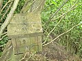 Birdbox on tree in Harper's Grove


References[edit]
- ^ "Harper's Grove – Lord's Grove". Countryside Council for Wales. Retrieved 21 March 2012.[permanent dead link]
- ^ "Harper's Grove – Lord's Grove map" (pdf). Countryside Council for Wales. Retrieved 21 March 2012.[permanent dead link]
- ^ Ordnance Survey: Explorer map sheet OL14 Wye Valley & Forest of Dean ISBN 9780319240953
This article about a Site of Special Scientific Interest is a stub. You can help Wikipedia by expanding it. |
This article relating to a location in Monmouthshire is a stub. You can help Wikipedia by expanding it. |