
Kolová
Kolová | |
|---|---|
 A park in Kolová | |
 Flag  Coat of arms | |
 Kolová Location in the Czech Republic | |
| Coordinates: 50°11′15″N 12°54′12″E / 50.18750°N 12.90333°E | |
| Country | |
| Region | Karlovy Vary |
| District | Karlovy Vary |
| First mentioned | 1785 |
| Area | |
| • Total | 7.03 km2 (2.71 sq mi) |
| Elevation | 575 m (1,886 ft) |
| Population (2023-01-01)[1] | |
| • Total | 874 |
| • Density | 120/km2 (320/sq mi) |
| Time zone | UTC+1 (CET) |
| • Summer (DST) | UTC+2 (CEST) |
| Postal codes | 360 01 |
| Website | kolova-haje |
Kolová (German: Kohlhau, Kohlau) is a municipality and village in Karlovy Vary District in the Karlovy Vary Region of the Czech Republic. It has about 900 inhabitants.
Administrative parts[edit]
The village of Háje is an administrative part of Kolová.
Demographics[edit]
| Year | Pop. | ±% |
|---|---|---|
| 1869 | 787 | — |
| 1880 | 856 | +8.8% |
| 1890 | 931 | +8.8% |
| 1900 | 1,001 | +7.5% |
| 1910 | 1,056 | +5.5% |
| 1921 | 947 | −10.3% |
| 1930 | 971 | +2.5% |
| 1950 | 465 | −52.1% |
| 1961 | 503 | +8.2% |
| 1970 | 481 | −4.4% |
| 1980 | 453 | −5.8% |
| 1991 | 487 | +7.5% |
| 2001 | 553 | +13.6% |
| 2011 | 711 | +28.6% |
| 2021 | 819 | +15.2% |
| Source: Censuses[2][3] | ||
Gallery[edit]
-
 General store
 -
 Municipal office
 -
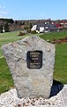 Memorial of victims of wars and injustice


References[edit]
- ^ "Population of Municipalities – 1 January 2023". Czech Statistical Office. 2023-05-23.
- ^ "Historický lexikon obcí České republiky 1869–2011 – Okres Karlovy Vary" (in Czech). Czech Statistical Office. 2015-12-21.
- ^ "Population Census 2021: Population by sex". Public Database. Czech Statistical Office. 2021-03-27.
Wikimedia Commons has media related to Kolová.
| Authority control databases: National |
|---|
This Karlovy Vary Region location article is a stub. You can help Wikipedia by expanding it. |