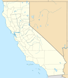
San Rafael Rock Quarry
 The San Rafael Rock Quarry, viewed from above | |
| Location | |
|---|---|
| Location | San Rafael |
| State | California |
| Country | United States |
| Coordinates | 37°59′12″N 122°27′11″W / 37.9868°N 122.4531°W |
| Production | |
| Products | Granite, Basalt, Limestone, Sandstone, Gravel |
| Greatest depth | 250 feet (76 m) below sea level |
| History | |
| Opened | 1929 |
| Owner | |
| Company | Dutra Group |
| Website | https://www.sanrafaelrockquarry.com/ |
The San Rafael Rock Quarry, also commonly known as the McNear Quarry, is a 172 acres (70 ha) granite quarry located east of San Rafael, California. Stone from the quarry has been used in many places, such as for levee maintenance in Novato and the Sacramento-San Joaquin Delta, and road improvement in Larkspur and San Francisco.[1]
History[edit]
Although the McNear Brickyard had been there since 1870, the land upon which the quarry now stands stayed a dairy farm for longer. Hard rock quarrying began in 1929. Trouble began in 1972, when conflicting reports and general confusion about quarry operations threatened the quarry, which indicated it would shut down in 1993 as a result. The county subsequently rezoned the land, but the quarry stayed, operating as a nonconforming use which it still does today.[2][3][4] The quarry was previously called the "Bull Quarry"[5]
Location[edit]
The Quarry is located on the eastern end of the San Pedro Peninsula, directly south of McNear's Beach. The Quarry's waterfront location makes it simple to load rock directly onto barges for transport. Rock is also exported by trucks.[6]
Operation[edit]
As of June 1914, the quarry produced an average of 2500 tons per day. Much of the rock is a hard, bluish, Franciscan metamorphic sandstone, alongside shale.[5] The main quarry bowl is approximately 1,800 feet (550 m) wide from west to east, and 800 feet (240 m) wide from south to north, and has a maximum depth of 250 feet (76 m) below sea level. A seasonal pond can form at the bottom of the pit during the rainy season.[7]
Reclamation[edit]
The Quarry has been reclaiming used mine land, specifically into wetlands. They are currently in the process of reclaiming a 7-acre tract of previously mined land.[8] They have also been working to preserve the existing wetland west of the quarry.[9]
References[edit]
- ^ "Local Projects". Dutra San Rafael Rock Quarry. Retrieved 2024-05-02.
- ^ Wood, Jim (2007-09-10). "The Quarry Quandry". Marin Magazine. Retrieved 2024-05-02.
- ^ "San Rafael Rock Quarry begins reclamation project". Marin Independent Journal. 2018-06-29. Retrieved 2024-05-02.
- ^ "POINT SAN PEDRO ROAD COALITION v. San Rafael Rock Quarry, Inc". FindLaw. Court of Appeal, First District, Division 3, California. March 6, 2019. Retrieved May 2, 2024.
- ^ a b Bradley, Walter Wadsworth (1915). Mines and mineral resources of the counties of Colusa, Glenn, Lake, Marin, Napa, Solano, Sonoma, Yolo. Sacramento: California State Printing Office. pp. 78–81. OL 1558896W.
- ^ "FAQs". Dutra San Rafael Rock Quarry. Retrieved 2024-05-02.
- ^ San Rafael Rock Quarry Amended Reclamation Plan and Amended Surface Mining and Quarrying Permit (PDF) (Report). Combined Final Environmental Impact Report (FEIR). Vol. FEIR Volume I: Revisions to the Draft EIR Text. Marin County Community Development Agency. January 2009. Retrieved 2024-05-02.
- ^ "San Rafael Rock Quarry To Begin Reclamation". San Rafael, CA Patch. 2018-06-25. Retrieved 2024-05-02.
- ^ "San Rafael Rock Quarry Wetlands". Pt. San Pedro Road Coalition. 2014-08-24. Retrieved 2024-05-02.

