
Monte Padro
| Monte Padro | |
|---|---|
| Padru (Corsican) | |
 | |
| Highest point | |
| Elevation | 2,389 m (7,838 ft) |
| Prominence | 552 m (1,811 ft) |
| Isolation | 7.2 km (4.5 mi) to Capu Biancu |
| Coordinates | 42°27′59″N 8°59′20″E / 42.46639°N 8.98889°E |
| Geography | |
 Monte Padro | |
| Country | France |
| Department | Haute-Corse |
| Parent range | Monte Cinto massif |
Monte Padro (Corsican: Padru) is a 2,389 metres (7,838 ft) mountain in the department of Haute-Corse on the island of Corsica, France. It is in the Monte Cinto massif.
Location[edit]
Monte Padro is on the ridge that defines the border between the communes of Olmi-Cappella to the north and Asco to the south.[1][2] The ridge slopes down to the east into the island's central valley.[2] The village of Asco is to the southeast of the mountain. The Asco river runs past the south of the mountain, with the D147 road running parallel to the road.[1]
Physical[edit]
Monte Padro is 2,389 metres (7,838 ft) high.[2] It has a prominence of 552 metres (1,811 ft) and isolation of 7.18 kilometres (4.46 mi). from its nearest higher neighbor, the 2,562 metres (8,406 ft) Capu Biancu, to the south.[3][4] The 2,395 metres (7,858 ft) Cima di a Statoghia is to the west, and the 2,144 metres (7,034 ft) Monte Corona is further to the west.[1] Streams draining the south slopes of Monte Padru are tributaries to the Asco river, while streams draining the northern slopes are tributaries of the Tartagine river.[2]
Gallery[edit]
-
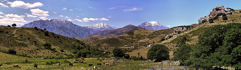 Monte Padru seen from the "Balanina" in Pietralba

Notes[edit]
Sources[edit]
- "Monte Padro", PeakVisor, retrieved 2021-02-01
- "Monte Padru, France", Peakbagger, retrieved 2022-02-01
- "Monte Padru", Géoportail (in French)
- "Node: Monte Padro (26863917)", OpenStreetMap, retrieved 2022-02-01
Landforms of the Haute-Corse department | ||
|---|---|---|
| Massifs |  | |
| Peaks | ||
| Passes | ||
| ||