
Pindi Balochan
Pindi Balochan | |
|---|---|
Village | |
 View from water tower | |
 Pindi Balochan Location in Punjab, India  Pindi Balochan Pindi Balochan (India) | |
| Coordinates: 30°41′16″N 74°30′03″E / 30.6877°N 74.5008°E | |
| Country | India |
| State | Punjab |
| District | Faridkot |
| Government | |
| • Body | Gram Panchayat |
| Area | |
| • Total | 10.77 km2 (4.16 sq mi) |
| Population (2011) | |
| • Total | 1,632 |
| • Density | 150/km2 (390/sq mi) |
| Languages | |
| • Official | Punjabi |
| Time zone | UTC+5:30 (IST) |
| Nearest city | Guruharsahi |
Pindi Balochan is a village in Faridkot district of Punjab (India). It is situated on the outskirts of Faridkot, Muktsar and Ferozepur three districts. The village Pindi belongs to tehsil Faridkot.
Demographics[edit]
The area of village is 1077 hectares, according to the 2011 census the total population of this village was 1632.[1] The post office near this village is situated 3 kilometers away, PIN code is 151212. The nearest railway station is Guru Harsahai. The Gang canal passes through this village which goes to Rajasthan.[2] A branch of HDFC Bank is also situated in the village.[3] There is one government elementary school and two private schools named Navyug Public School[4] and Taj Public School[5] are in the village.
Gallery[edit]
-
 Gang canal in village (2018)
 -
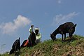 Shepherd in Pindi Balochan
 -
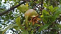 Pomegranate tree in Pindi


References[edit]
- ^ "Pindi Balochan Village Population - Faridkot - Faridkot, Punjab". Census2011.co.in.
- ^ "Gang Canal System and its Modernization". Biologydiscussion.com. 19 July 2014.
- ^ "HDFC Bank Branch in Pindi Balochan, Faridkot 151212". Hdfcbank.com.
- ^ "Navyug Pub Sch Pindi Balonchan School, Faridkot - Admissions, Fees, Address, Reviews 2019". Icbse.com.
- ^ "Taj public School". Tajpublicschool.com.
External links[edit]
This article about a location in the Indian state of Punjab is a stub. You can help Wikipedia by expanding it. |