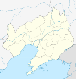
Tayu, Liaoning
This article is an orphan, as no other articles link to it. Please introduce links to this page from related articles; try the Find link tool for suggestions. (March 2024) |
Tayu
塔峪镇 | |
|---|---|
| Coordinates: 41°47′34″N 123°51′48″E / 41.79278°N 123.86333°E | |
| Country | People's Republic of China |
| Province | Liaoning |
| Prefecture-level city | Fushun |
| District | Wanghua District |
| Time zone | UTC+8 (China Standard) |
Tayu (Chinese: 塔峪; pinyin: Tǎyù) is a town under the administration of Wanghua District, Fushun, Liaoning, China.[1] As of 2023[update], it administers the following fifteen villages:[2]
- Tayu Village
- Chengjia Village (程家村)
- Heping Village (和平村)
- Houerdao Village (后二道村)
- Qian'erdao Village (前二道村)
- Qiangujiazi Village (前孤家子村)
- Hougujiazi Village (后孤家子村)
- Shanchengzi Village (山城子村)
- Dadianzi Village (大甸子村)
- Yingjia Village (英家村)
- Xiaosi Village (小泗村)
- Xiaojia Village (肖家村)
- Tayu Ethnic Korean Village (塔峪朝鲜族村)
- Wangliang Village (汪良村)
- Wulao Village (五老村)
References[edit]
- ^ 2023年统计用区划代码和城乡划分代码:望花区 (in Chinese). National Bureau of Statistics of the People's Republic of China. Retrieved 28 February 2024.
- ^ 2023年统计用区划代码和城乡划分代码:塔峪镇 (in Chinese). National Bureau of Statistics of the People's Republic of China. Retrieved 28 February 2024.

