Tantallon, Saskatchewan
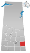
Tantallon (2016 population: 91) is a village in the Canadian province of Saskatchewan within the Rural Municipality of Spy Hill No. 152 and Census Division No. 5. It is in the Qu'Appelle Valley along the Qu'Appelle River about 39 km east of Round Lake (Saskatchewan). The community celebrated its centennial in 2004.
The community was founded in 1904 and takes its name from a homestead (which was named "Tantallon" by Scottish Canadian James Moffat Douglas (former Canadian MP and Senator), who said this part of the Qu'Appelle Valley reminded him of Tantallon Castle in Scotland.
The village has an ice rink and a senior's centre. The community's school closed due to a lack of students, who are now bused to Esterhazy.
History[edit]
Tantallon incorporated as a village on June 17, 1904.[1]
Demographics[edit]
In the 2021 Census of Population conducted by Statistics Canada, Tantallon had a population of 84 living in 48 of its 51 total private dwellings, a change of -7.7% from its 2016 population of 91. With a land area of 0.84 km2 (0.32 sq mi), it had a population density of 100.0/km2 (259.0/sq mi) in 2021.[4]
In the 2016 Census of Population, the Village of Tantallon recorded a population of 91 living in 49 of its 49 total private dwellings, a -15.4% change from its 2011 population of 105. With a land area of 0.84 km2 (0.32 sq mi), it had a population density of 108.3/km2 (280.6/sq mi) in 2016.[5]
References[edit]
- ^ "Urban Municipality Incorporations". Saskatchewan Ministry of Government Relations. Archived from the original on October 15, 2014. Retrieved June 1, 2020.
- ^ "Saskatchewan Census Population" (PDF). Saskatchewan Bureau of Statistics. Archived from the original (PDF) on September 24, 2015. Retrieved May 31, 2020.
- ^ "Saskatchewan Census Population". Saskatchewan Bureau of Statistics. Retrieved May 31, 2020.
- ^ "Population and dwelling counts: Canada, provinces and territories, census divisions and census subdivisions (municipalities), Saskatchewan". Statistics Canada. February 9, 2022. Retrieved April 1, 2022.
- ^ "Population and dwelling counts, for Canada, provinces and territories, and census subdivisions (municipalities), 2016 and 2011 censuses – 100% data (Saskatchewan)". Statistics Canada. February 8, 2017. Retrieved May 30, 2020.


