
Bandama Caldera
This article needs additional citations for verification. (July 2015) |

The Bandama Natural Monument is part of the Tafira Protected Landscape on the island of Gran Canaria in the Canary Islands, Spain. It is considered a point of geological interest, because of the Caldera de Bandama. This volcanic crater, which is geologically a maar rather than a caldera,[1] reaches 569 m (1,867 ft) above sea level at the highest point on its rim, Pico de Bandama, and is about 1,000 m (3,300 ft) wide and 200 m (700 ft) deep. The crater was developed during the last heavy eruptions 2000 years ago. It is recorded as the most recent volcanic activity on Gran Canaria.[2]
The bottom of the caldera contains volcanic ash of different colors, and some botanic species of Canary Islands origin. An endemic bush can be found inside the caldera that doesn't grow anywhere else; Dama de Bandama[3] (parolinia grabiuscula).
The Caldera de Bandama is located at the meeting point of three municipalities: Las Palmas de Gran Canaria, Santa Brígida and Telde.
Gallery[edit]
-
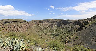 Caldera de Bandama, Gran Canaria
 -
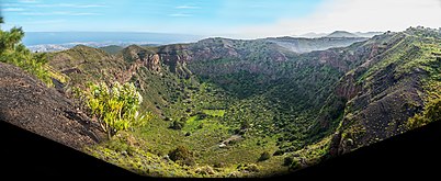 Caldera de Bandama, 2016
 -
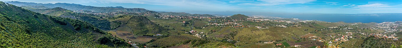 View toward the northeast from Pico de Bandama, 2016


References[edit]
- ^ "Gran Canaria: Synonyms & Subfeatures". Global Volcanism Program. Smithsonian Institution. Retrieved 2021-06-26.
- ^ "The Geology of the Canary Islands - 1st Edition". www.elsevier.com. Retrieved 2022-12-13.
- ^ "Hiking Tips for Caldera de Bandama in Gran Canaria". January 2022. Archived from the original on 2022-02-01.
External links[edit]
- Monumento Natural de Bandama, official info, in Spanish
28°02′0″N 15°27′20″W / 28.03333°N 15.45556°W
| Governance |   | ||||||||
|---|---|---|---|---|---|---|---|---|---|
| Municipalities | |||||||||
| History | |||||||||
| Nature | |||||||||
| Landmarks and attractions |
| ||||||||
| Transport |
| ||||||||
| Sport | |||||||||
| Education and science | |||||||||
| International | |
|---|---|
| Geographic | |