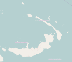
Weilo
Weilo | |
|---|---|
Village | |
| Coordinates: 4°05′53″S 152°59′37″E / 4.09806°S 152.99361°E | |
| Country | |
| Province | New Ireland Province |
| District | Namatanai District |
Weilo is a village on the south-eastern coast of New Ireland, Papua New Guinea. The Weilo River flows nearby.[1] It is located in Konoagil Rural LLG.[2]
References[edit]
- ^ Marlow, Michael S. (1988). Geology and offshore resources of Pacific island arcs--New Ireland and Manus Region, Papua New Guinea. Circum-Pacific Council for Energy and Mineral Resources. p. 26. ISBN 978-0-933687-10-3. Retrieved 31 December 2012.
- ^ United Nations in Papua New Guinea (2018). "Papua New Guinea Village Coordinates Lookup". Humanitarian Data Exchange. 1.31.9.

