Sig railway station
This article needs additional citations for verification. (November 2023) |
Sig | |||||||||||
|---|---|---|---|---|---|---|---|---|---|---|---|
| Railway station | |||||||||||
 Sig station in 2011 | |||||||||||
| General information | |||||||||||
| Location | Stationsvej 19 Sig 6800 Varde[1][2] Denmark | ||||||||||
| Coordinates | 55°39′57″N 8°34′38″E / 55.66583°N 8.57722°E | ||||||||||
| Owned by | Banedanmark | ||||||||||
| Operated by | GoCollective[1] | ||||||||||
| Line(s) | Esbjerg-Struer railway line | ||||||||||
| Platforms | 1 | ||||||||||
| Tracks | 1 | ||||||||||
| History | |||||||||||
| Opened | 1878[3] | ||||||||||
| Services | |||||||||||
| |||||||||||
| Location | |||||||||||
 | |||||||||||
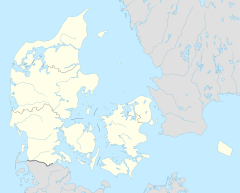
Sig station is a railway station serving the village of Sig near Varde in West Jutland, Denmark.[1][2]
Sig station is located on the Esbjerg–Struer railway line from Esbjerg to Struer. The station opened in 1878.[3] It offers regional rail services to Aarhus, Esbjerg, Herning and Skjern, operated by the railway company GoCollective.[1]
History[edit]
The station opened in 1878 as a railway halt with ticket sales on the Esbjerg–Struer railway line, which had opened three years before. It was later promoted to a station. It has been unstaffed since 1970.[3]
Services[edit]
The station offers direct regional rail services to Esbjerg, Skjern, Herning and Aarhus, operated by the railway company GoCollective.[1]
See also[edit]
References[edit]
Citations[edit]
- ^ a b c d e "Sig Station" (in Danish). GoCollective. Retrieved 20 April 2024.
- ^ a b "Sig Station" (in Danish). DSB. Retrieved 15 November 2023.
- ^ a b c "Sig Station". danskejernbaner.dk (in Danish). Retrieved 15 November 2023.
Bibliography[edit]
- Jensen, Niels (1977). Vestjyske jernbaner (in Danish). Copenhagen: J.Fr. Clausens Forlag. ISBN 87-11-03821-7.
External links[edit]
Wikimedia Commons has media related to Sig Station.
- (in Danish) Banedanmark – government agency responsible for maintenance and traffic control of most of the Danish railway network
- (in Danish) GoCollective – private public transport company operating bus and train services in Denmark
- (in Danish) Danske Jernbaner – website with information on railway history in Denmark


