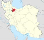
Narjeh Rural District
Narjeh Rural District
Persian: دهستان نرجه | |
|---|---|
| Coordinates: 36°01′40″N 49°38′50″E / 36.02778°N 49.64722°E[1] | |
| Country | Iran |
| Province | Qazvin |
| County | Takestan |
| District | Central |
| Capital | Narjeh |
| Population (2016)[2] | |
| • Total | 555 |
| Time zone | UTC+3:30 (IRST) |
Narjeh Rural District (Persian: دهستان نرجه) is in the Central District of Takestan County, Qazvin province, Iran. It is administered from the city of Narjeh.[3]
At the National Census of 2006, its population was 923 in 254 households.[4] There were 739 inhabitants in 233 households at the following census of 2011.[5] At the most recent census of 2016, the population of the rural district was 555 in 183 households. The most populous of its 23 villages was Qarah Bagh, with 332 people.[2]
References[edit]
- ^ OpenStreetMap contributors (17 May 2023). "Narjeh Rural District (Takestan County)" (Map). OpenStreetMap. Retrieved 17 May 2023.
- ^ a b "Census of the Islamic Republic of Iran, 1395 (2016)". AMAR (in Persian). The Statistical Center of Iran. p. 26. Archived from the original (Excel) on 30 November 2021. Retrieved 19 December 2022.
- ^ Habibi, Hassan (28 March 1370). "Carrying out reforms in the villages of Zanjan province". Lamtakam (in Persian). Ministry of Interior, Defense Political Commission of the Government Council. Archived from the original on 17 December 2023. Retrieved 9 January 2024.
- ^ "Census of the Islamic Republic of Iran, 1385 (2006)". AMAR (in Persian). The Statistical Center of Iran. p. 26. Archived from the original (Excel) on 20 September 2011. Retrieved 25 September 2022.
- ^ "Census of the Islamic Republic of Iran, 1390 (2011)". Syracuse University (in Persian). The Statistical Center of Iran. p. 26. Archived from the original (Excel) on 19 January 2023. Retrieved 19 December 2022.


