Bezengi Glacier
This article needs additional citations for verification. (August 2023) |
| Bezengi Glacier | |
|---|---|
 Bezengi Wall and Bezengi Glacier | |
| Type | Valley |
| Location | Kabardino-Balkaria, Russia |
| Coordinates | 43°03′25″N 43°05′49″E / 43.0569°N 43.0969°E |
| Area | 36 km2 |
| Length | 17.6 km |
| Terminus | 9 km moraine |
| Status | Growing |
 | |
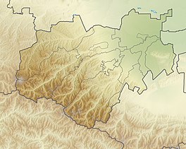
The Bezengi Glacier (Karachay-Balkar: Uluchiran) is a vast valley-type glacier in the Republic of Kabardino-Balkaria, Russia, near the northern slope of the Main Caucasian Range of the Caucasus.[1] [2]
Morphology[edit]
The Bezengi Glacier runs from the peaks of Shkhara and Janga until it drops to height 2000 m. Glacier area 36 km, length 17.6 km, tongue about 9 km. Much of the tongue of the mare is covered with moraines and fragments. The Bezengi Glacier is a source of the river Cherek.
See also[edit]
References[edit]
- ^ Friedrich Bender Classic Climbs in the Caucasus: 80 Selected Climbs in the Elbrus and Bezingi Regions of the Svanetian Range Menasha Ridge Press, 1992, 318 pages ISBN 0897321162, ISBN 9780897321167
- ^ Klok, E. J., and J. Oerlemans. Climate Reconstructions Derived from Global Glacier Length Records. Arctic, Antarctic, and Alpine Research, vol. 36, no. 4, 2004, pp. 575–583. JSTOR, www.jstor.org/stable/1552311. Accessed 28 Sept. 2020.


