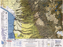
Sura K'uchu (Bolivia)

Sura K'uchu (Aymara sura dry jiquima, a species of Pachyrhizus, k'uchu, q'uch'u corner,[1] "sura corner", hispanicized spelling Sora Khucho) is a region in the Cordillera Occidental in the Andes of Bolivia. It is located in the Oruro Department, Sajama Province, Turku Municipality, Chachakumani Canton. Sura K'uchu is situated south-east of the Uqi Uqini volcano and north-east of the volcano Umurata. It lies south of National Route 4 near the Chungara-Tambo Quemado pass. The river Jaruma originates here. It flows to the north-east as an affluent of the Sajama River.[2][3]
See also[edit]
References[edit]
- ^ Radio San Gabriel, "Instituto Radiofonico de Promoción Aymara" (IRPA) 1993, Republicado por Instituto de las Lenguas y Literaturas Andinas-Amazónicas (ILLLA-A) 2011, Transcripción del Vocabulario de la Lengua Aymara, P. Ludovico Bertonio 1612 (Spanish-Aymara-Aymara-Spanish dictionary) see: Jiquima seca;rincón and q'uch'u
- ^ BIGM map 1:50,000 Quisi Quisini Hoja 5739-II
- ^ "Turco". Retrieved September 18, 2014.
