
Pamėkliai
Pamėkliai | |
|---|---|
Village | |
 | |
 Pamėkliai Location in Lithuania  Pamėkliai Pamėkliai (Lithuania) | |
| Coordinates: 55°11′20″N 23°57′00″E / 55.18889°N 23.95000°E | |
| Country | |
| County | |
| Municipality | Kėdainiai district municipality |
| Eldership | Pelėdnagiai Eldership |
| Population (2011) | |
| • Total | 42 |
| Time zone | UTC+2 (EET) |
| • Summer (DST) | UTC+3 (EEST) |
Pamėkliai (formerly Russian: Помекли, Polish: Pomiekle)[1] is a village in Kėdainiai district municipality, in Kaunas County, in central Lithuania. According to the 2011 census, the village had a population of 42 people.[2] It is located 3 kilometres (1.9 mi) from Labūnava, by the Labūnava Reservoir (on the former confluence of the Mėkla and the Barupė).
Demography[edit]
|
| ||||||||||||||||||||||||||||||
| Source: 1902, 1923, 1959 & 1970, 1979, 1989, 2001, 2011 | |||||||||||||||||||||||||||||||
Images[edit]
-
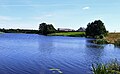
 Pamėkliai and the Labūnava Reservoir
 -
 Pamėkliai and the Labūnava Reservoir
 -
 Pamėkliai from the eastern side


References[edit]
- ^ "Pomiekle". Geographical Dictionary of the Kingdom of Poland (in Polish). 15 pt. 2. Warszawa: Kasa im. Józefa Mianowskiego. 1902. p. 491.
- ^ "2011 census". Statistikos Departamentas (Lithuania). Retrieved August 21, 2017.