Taq-e Gavarin
Taq-e Gavarin
Persian: طاق گاورين | |
|---|---|
Village | |
| Coordinates: 33°41′10″N 46°43′43″E / 33.68611°N 46.72861°E[1] | |
| Country | Iran |
| Province | Ilam |
| County | Chardavol |
| District | Zagros |
| Rural District | Bijnavand |
| Population (2016)[2] | |
| • Total | 511 |
| Time zone | UTC+3:30 (IRST) |
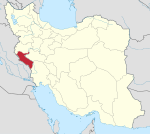
Taq-e Gavarin (Persian: طاق گاورين)[a] is a village in Bijnavand Rural District of Zagros District, Chardavol County, Ilam province, Iran. The village is populated by Kurds.[4]
At the 2006 National Census, its population was 533 in 128 households.[5] The following census in 2011 counted 581 people in 153 households.[6] The latest census in 2016 showed a population of 511 people in 155 households, by which time the rural district had been separated from the district in the establishment of Zagros District.[7] It was the most populous village in its rural district.[2]
Notes[edit]
References[edit]
- ^ OpenStreetMap contributors (3 June 2023). "Taq-e Gavarin, Chardavol County" (Map). OpenStreetMap. Retrieved 3 June 2023.
- ^ a b "Census of the Islamic Republic of Iran, 1395 (2016)". AMAR (in Persian). The Statistical Center of Iran. p. 16. Archived from the original (Excel) on 1 November 2020. Retrieved 19 December 2022.
- ^ Taq-e Gavarin can be found at GEOnet Names Server, at this link, by opening the Advanced Search box, entering "-3794355" in the "Unique Feature Id" form, and clicking on "Search Database".
- ^ "Language distribution: Ilam Province". Iran Atlas. Retrieved 24 March 2021.
- ^ "Census of the Islamic Republic of Iran, 1385 (2006)". AMAR (in Persian). The Statistical Center of Iran. p. 16. Archived from the original (Excel) on 20 September 2011. Retrieved 25 September 2022.
- ^ "Census of the Islamic Republic of Iran, 1390 (2011)". Syracuse University (in Persian). The Statistical Center of Iran. p. 16. Archived from the original (Excel) on 17 January 2023. Retrieved 19 December 2022.
- ^ Rahimi, Mohammad Reza (7 July 2013). "With some changes in the geography map of Alborz and Ilam provinces: The counties of Fardis and Badreh and the city of Balavah were added to the map of the country's divisions". DOLAT (in Persian). Ministry of Interior, Board of Ministers. Archived from the original on 10 January 2017. Retrieved 11 November 2023.


