
Mount Uyuni
| Uyuni | |
|---|---|
 Uyuni Location in Bolivia | |
| Highest point | |
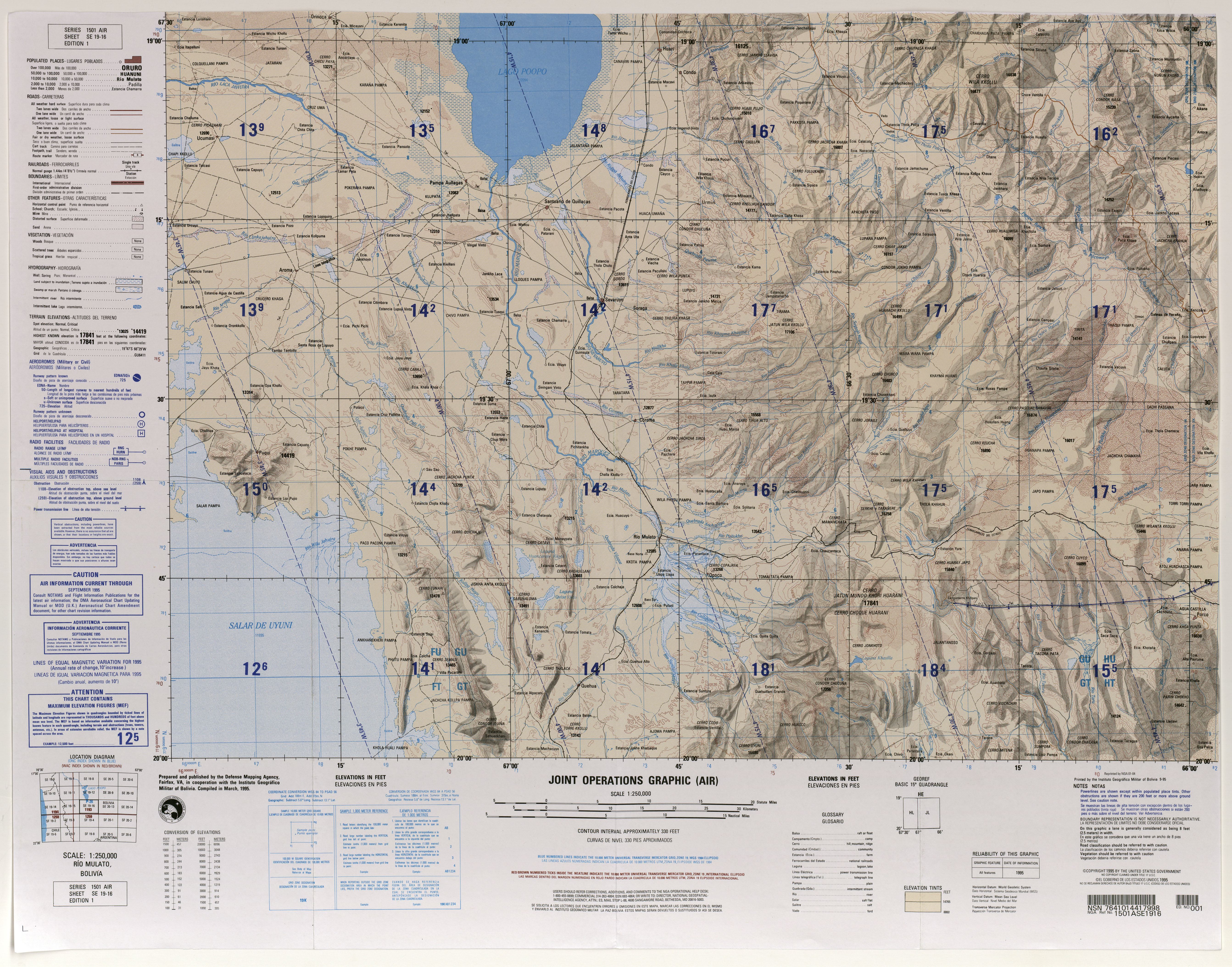
| Elevation | 5,084 m (16,680 ft)[1] |
| Coordinates | 20°00′S 66°35′W / 20.000°S 66.583°W |
| Geography | |
| Location | Bolivia, Potosí Department, Antonio Quijarro Province, Tomave Municipality |
| Parent range | Andes |
Uyuni (Aymara, uyu pen (enclosure), yard, cemetery,[2] -ni a suffix to indicate ownership, "the one that has got a pen", "the one with a pen") is a mountain in the Andes of Bolivia, about 5,084 metres (16,680 ft) high. It is situated in the Potosí Department, Antonio Quijarro Province, Tomave Municipality, Tomave Canton,[3] east of the Uyuni salt flat and south-west of the Nuevo Mundo volcano (Jatun Mundo Quri Warani) and Kuntur Chukuña.
See also[edit]
References[edit]
- ^ lib.utexas.edu Map (17,356 ft)
- ^ Ludovico Bertonio, Aymara-Spanish dictionary (Transcription): Uyu - Cerca o corral o cementerio
- ^ Tomave Municipality: Archived 2014-01-02 at the Wayback Machine population data and map