
Letcher County, Kentucky
Letcher County | |
|---|---|
 Letcher County courthouse in Whitesburg | |
 Location within the U.S. state of Kentucky | |
 Kentucky's location within the U.S. | |
| Coordinates: 37°07′N 82°51′W / 37.12°N 82.85°W | |
| Country | |
| State | |
| Founded | 1842 |
| Named for | Robert P. Letcher |
| Seat | Whitesburg |
| Largest city | Jenkins |
| Area | |
| • Total | 339 sq mi (880 km2) |
| • Land | 338 sq mi (880 km2) |
| • Water | 1.1 sq mi (3 km2) 0.3% |
| Population (2020) | |
| • Total | 21,548 |
| • Estimate (2023) | 20,423 |
| • Density | 64/sq mi (25/km2) |
| Time zone | UTC−5 (Eastern) |
| • Summer (DST) | UTC−4 (EDT) |
| Congressional district | 5th |
| Website | letchercounty |
Letcher County is a county located in the U.S. state of Kentucky. As of the 2020 census, the population was 21,548.[1] Its county seat is Whitesburg.[2][3] It was created in 1842 from Harlan and Perry counties,[4] and named for Robert P. Letcher, Governor of Kentucky from 1840 to 1844.[5][6][7]
History[edit]
Settlement and early history[edit]
The area now known as Letcher County was first settled in the early–1800s by the Caudill, Dixon, Stamper, Collier, Lewis, Whitaker, Wright, Craft, Brown, Halcomb, Holbrook, and Bentley families. These early families were later joined by the Maggard, Banks, Day, Fields, Morgan, Blair, Breeding, Frazier, Baker, Hogg, Combs, and Mullins families. The first permanent settlement in the county was settled in 1803, at the mouth of Pert Creek, in modern-day Whitesburg. In 1804, George Ison II and his family settled in the area of Linefork. Later, Benjamin Webb brought a group of settlers from Maryland, and settled at the mouth of Boone Fork in modern-day Kona, but later moved down towards the mouth of Bottom Fork in modern-day Mayking. Most communities and geographic features in the area were named after these early pioneer families. Most of these early communities were economically supported by timber logging.[8]
Formation[edit]

In 1842, the residents of modern-day Letcher County petitioned the state legislature for a new county, as at that time they belonged to Harlan, Perry, and Pike counties. The legislature met in January 1842, and decided to form the new county.[9] The county was formed, as Kentucky's 95th county, from portions of Harlan, Perry, and Pike counties, and named for Robert P. Letcher, who was the governor of Kentucky at that time. Its county seat, Whitesburg, was called Summit City before becoming the county seat. The city was renamed from Summit City to Whitesburg in 1842, in honor of John D. White, who introduced the county's enactment bill in the Kentucky General Assembly.[10][4] The state government commissioned members of the general assembly to draw the boundaries for the new county. These men were Nathaniel Collins, Stephen Hiram Hogg, Benjamin Adams, and Benjamin Webb.[9] In 1858, 60 square miles from Perry County were added to the county's original 340 square miles. In April 1884, a ten mile section from Pike County was added, and a month later, Letcher County contributed 80 square miles toward the creation of Knott County.[8]
History of the courthouse[edit]

At first, residents could not agree where the county seat would be located. Some residents wanted the seat to be in Mayking, others wanted the seat to be in Camp Branch or Indian Bottom. The debate was settled when Stephen Hiram Hogg donated his land in Whitesburg for the building of the courthouse. The first court session was held in a log cabin owned by Mose Adams at the Adams settlement, which was located two-miles up the North Fork Kentucky River from Whitesburg. John A. Caudill was hired to build the new courthouse and completed it in 1844.[9][11]

The first courthouse built by Caudill was built of logs, and had plank trimming. It was demolished in 1897, due to its failing condition. Lemuel R. Perry was commissioned to construct the new courthouse. The new courthouse was built of bricks, and had a large cupola, with a bell inside to call the jury into session. This new courthouse was heated by stoves and fireplaces until an addition was built in the late–1930s, by the Works Progress Administration. By the 1960s, the courthouse was deemed too small, and prisoners in the jails at the top floor would often escape by pushing apart the bars, climbing out the window, and sliding down a rope of bedsheets. The Area Redevelopment Administration provided funding to build a new one.[9][11]
William Banton Moore, an architect from Louisville, was hired to design the new courthouse. Ramsey and Clubb, a construction company from Shelbyville, Kentucky, was hired to build it. It was completed in 1965, and a dedication ceremony was held with governor Bert Combs in attendance. The new courthouse had a contemporary design with blue and beige panels. It also had a jail located on the top floor and a public library at the bottom. The construction of the new courthouse costed about US$650,000. Many locals were dissatisfied with the look of the new courthouse, believing it looked too much like a gas station.[9][11]

By the 1990s, the courthouse was in disrepair, and state officials were threatening to close the top floor. Local government officials were able to obtain federal funding, and the building was remodeled in 1998. The jail, which was located at the top floor of the building, was moved to the bottom floor, and a statue honoring veterans was moved to the front of the building. This is the current version of the Letcher County courthouse.[11]
Coal[edit]
Due to its rugged terrain, Letcher County was one of the most remote counties in Kentucky, and until the arrival of coal, its population never peaked above 10,000.[8][12] In the early–1900s, coal mining began in the county. This caused an economic boom as many small communities grew to large coal towns supported by coal companies.[8] By 1940, the county's population had grown to over 40,000.[12] Between 1990 and 2014, Letcher County produced over 600,000,000 short tons (540,000,000 t) of coal.[13]
Modern period[edit]
Harry M. Caudill's 1963 book, Night Comes to the Cumberlands: A Biography of a Depressed Area, brought the county to national attention. The CBS documentary Christmas in Appalachia (1964) hosted by Charles Kuralt also brought the nation's attention to Letcher County as citizens sent clothes and gifts in response to the conditions of those featured.[14]

On March 9, 1976, in the community of Oven Fork, an explosion caused by coal dust and gasses occurred at the Scotia Mine, resulting in the deaths of 15 miners. Two days later another explosion occurred, killing 11 more miners. Investigators concluded that the explosions were caused by methane gases that were ignited by a spark caused by a battery-powered device. The accidents are often considered two of the worst mining disasters in U.S. history. The two explosions led to the passage of the Federal Mine Safety and Health Act of 1977.[15][16]
In July–August 2022, floods came through Eastern Kentucky. A total of 45 people died,[17] three of those deaths occurred in Letcher County. As a result of the floods, many people were left homeless.[18]
Geography[edit]
Letcher County is located in the far southeast of Kentucky. Most of its border is defined by mountains. The 125-mile long Pine Mountain divides the county, and defines part of the county's border with Harlan County and Virginia. To the south, Black Mountain marks its border with Virginia.[19][20]
The county's terrain is defined by rugged mountains and blanketed by forests. Jefferson National Forest covers a significant portion of the county. The county's highest point is Black Mountain, located in the southeastern corner of the county, with an elevation of 3,700 feet.[20][21]

The northern part of the county is drained by Rockhouse Creek, which empty's into the North Fork Kentucky River near Blackey, Kentucky. The central portion of the county is drained by the North Fork Kentucky River, which flows from its start at the Kentucky–Virginia border, to where it meets the South Fork Kentucky River in Lee County, Kentucky, to form the Kentucky River. The southern part of the county is drained by the Poor Fork, which flows from its start on Pine Mountain, to Baxter in Harlan County, Kentucky, where it meets Martin's Fork to form the Cumberland River. The western portion of the county is drained by Elkhorn Creek, which flows from its start near Jenkins, Kentucky, to its confluence with Russell Fork in Pike County, Kentucky.[20]
According to the United States Census Bureau, the county has a total area of 339 square miles (880 km2), of which 338 square miles (880 km2) is land and 1.1 square miles (2.8 km2) (0.3%) is water.[22]
Fishpond Lake[edit]
Fishpond Lake is a 28.8 acres (11.7 ha)[23] man-made body of water near Jenkins, in Payne Gap, Kentucky.[20] It was formed in 1961 by the impoundment of Fishpond Branch.[24] At its deepest it is 79 feet and averages around 33 feet.[25] The lake is home to several species of fish including rainbow trout, channel catfish, and flathead catfish. It is the only large body of water (other than rivers) in Letcher County.[23]
Pioneer Horse Trail controversy[edit]
In an effort to bring tourists to Letcher County and to revitalize the local economy, the Pioneer Horse Trail was constructed on Pine Mountain.[26] The trail, part of an "adventure tourism" initiative spearheaded by then Governor Steve Beshear, Beshear's wife Jane, and Lieutenant Governor Daniel Mongiardo, was completed in 2009.[26]
.jpg)
However, controversy arose about whether the environment would be harmed during construction. In the summer of 2008, the Letcher County Fiscal Court had signed an agreement with state officials stating that the county would do an environmental impact study before construction would begin.[26] Documents obtained by the Lexington Herald-Leader under Kentucky's Open Records Act showed that construction actually began before the study was to take place. County-owned bulldozers started clearing trees in part of a wildlife management area in which heavy equipment was not permitted.[26] Environmental groups are asking the U.S. Fish and Wildlife Service to determine if any species on the threatened or endangered list were harmed.[26]
Major highways[edit]
Adjacent counties[edit]
- Knott County (northwest)
- Pike County (northeast)
- Wise County, Virginia (southeast)
- Harlan County (south)
- Perry County (southwest)
National protected area[edit]
- Jefferson National Forest (part)

State protected area[edit]
- Bad Branch Falls State Nature Preserve
- Lilley Cornett Woods Experiment Station (Eastern Kentucky University)
State Parks[edit]
Demographics[edit]
| Census | Pop. | Note | %± |
|---|---|---|---|
| 1850 | 2,512 | — | |
| 1860 | 3,904 | 55.4% | |
| 1870 | 4,608 | 18.0% | |
| 1880 | 6,601 | 43.3% | |
| 1890 | 6,920 | 4.8% | |
| 1900 | 9,172 | 32.5% | |
| 1910 | 10,623 | 15.8% | |
| 1920 | 24,467 | 130.3% | |
| 1930 | 35,702 | 45.9% | |
| 1940 | 40,592 | 13.7% | |
| 1950 | 39,522 | −2.6% | |
| 1960 | 30,102 | −23.8% | |
| 1970 | 23,165 | −23.0% | |
| 1980 | 30,687 | 32.5% | |
| 1990 | 27,000 | −12.0% | |
| 2000 | 25,277 | −6.4% | |
| 2010 | 24,519 | −3.0% | |
| 2020 | 21,548 | −12.1% | |
| 2023 (est.) | 20,423 | [27] | −5.2% |
| U.S. Decennial Census[28] 1790–1960[29] 1900–1990[30] 1990–2000[31] 2010–2020[1] | |||
As of the census of 2000, there were 25,277 people, 10,085 households, and 7,462 families residing in the county. The population density was 75 per square mile (29/km2). There were 11,405 housing units at an average density of 34 per square mile (13/km2). The racial makeup of the county was 98.71% White, 0.51% Black or African American, 0.10% Native American, 0.28% Asian, 0.02% Pacific Islander, 0.03% from other races, and 0.35% from two or more races. 0.44% of the population were Hispanic or Latino of any race.
There were 10,085 households, out of which 32.30% had children under the age of 18 living with them, 58.40% were married couples living together, 11.50% had a female householder with no husband present, and 26.00% were non-families. 24.10% of all households were made up of individuals, and 10.10% had someone living alone who was 65 years of age or older. The average household size was 2.48 and the average family size was 2.94.
The age distribution was 23.70% under the age of 18, 9.20% from 18 to 24, 28.70% from 25 to 44, 25.80% from 45 to 64, and 12.60% who were 65 years of age or older. The median age was 38 years. For every 100 females there were 95.80 males. For every 100 females age 18 and over, there were 92.10 males.
The median income for a household in the county was $21,110, and the median income for a family was $24,869. Males had a median income of $30,488 versus $17,902 for females. The per capita income for the county was $11,984. About 23.70% of families and 27.10% of the population were below the poverty line, including 35.90% of those under age 18 and 21.20% of those age 65 or over.
Education[edit]
Two public school districts operate in the county.
Letcher County Public Schools[edit]
This sectionion needs additional citations for verification. (January 2011) |
Most K-12 students in the county, with the exception of those living in the far eastern part of the county surrounding Jenkins, are served by the Letcher County Public Schools. The district operates nine elementary/middle schools, one vocational school, one high school, and an alternative education center.
In 2005, the doors to the new Letcher County Central High School[32] were opened in Ermine (the school's postal address, however, is in Whitesburg), with total costs of over $25,000,000. The school's nickname is the Cougars, and the school colors are blue, black, and silver. The school volleyball team has been to the state tournament every year since its creation and the wrestling team has had multiple regional champions. The baseball team has claimed three region titles in 2007, 2011, and 2013, with two state tournament appearances and one semi-state appearance.[33] The boys Cross Country team has had 3 region championships and an individual region champion. The Girls basketball team made a State sweet sixteen appearance.[34]
Jenkins Independent Schools[edit]
Students in the Jenkins area are served by the Jenkins Independent Schools, which operates two elementary schools (located on two campuses in the communities of McRoberts and Burdine[35]) and a combined middle and high school with grades 7–12. Jenkins Independent Schools celebrated its 100th year in 2012. The middle/high school's athletic nickname is the Cavaliers/Lady Cavaliers. The school colors are Kelly Green and White.
Politics[edit]
Letcher County has a somewhat similar political history to West Virginia. Under the Fourth Party System it was a reliable Republican county, voting Republican in every election from 1884[36] to 1928.[37] However, with increasing unionization under the New Deal it turned for the next sixty to seventy years into a fairly solid Democratic county, apart from the 1956 and 1972 landslides and the candidacy of John F. Kennedy. However, since 2004 as the Democratic Party has become opposed to coal production due to global warming issues, it has now become a solidly Republican county.
However, in the 2023 Kentucky Gubernatorial Election, popular incumbent Governor Andy Beshear won Letcher County by a margin of 4 points, marking the first instance since 2011[38] that a Democrat clinched victory in the county in any statewide race.
| Year | Republican | Democratic | Third party | |||
|---|---|---|---|---|---|---|
| No. | % | No. | % | No. | % | |
| 2020 | 7,226 | 79.10% | 1,799 | 19.69% | 110 | 1.20% |
| 2016 | 7,293 | 79.84% | 1,542 | 16.88% | 299 | 3.27% |
| 2012 | 6,811 | 77.77% | 1,702 | 19.43% | 245 | 2.80% |
| 2008 | 5,367 | 65.17% | 2,623 | 31.85% | 245 | 2.98% |
| 2004 | 4,801 | 52.96% | 4,192 | 46.24% | 72 | 0.79% |
| 2000 | 4,092 | 45.54% | 4,698 | 52.29% | 195 | 2.17% |
| 1996 | 2,222 | 30.75% | 4,160 | 57.57% | 844 | 11.68% |
| 1992 | 3,011 | 29.84% | 5,817 | 57.65% | 1,262 | 12.51% |
| 1988 | 3,601 | 43.16% | 4,697 | 56.29% | 46 | 0.55% |
| 1984 | 4,073 | 46.13% | 4,707 | 53.31% | 50 | 0.57% |
| 1980 | 3,426 | 43.82% | 4,280 | 54.75% | 112 | 1.43% |
| 1976 | 3,122 | 40.29% | 4,590 | 59.24% | 36 | 0.46% |
| 1972 | 4,213 | 58.54% | 2,908 | 40.41% | 76 | 1.06% |
| 1968 | 3,243 | 42.30% | 3,499 | 45.64% | 925 | 12.06% |
| 1964 | 2,632 | 32.64% | 5,420 | 67.22% | 11 | 0.14% |
| 1960 | 4,408 | 50.87% | 4,258 | 49.13% | 0 | 0.00% |
| 1956 | 5,741 | 57.97% | 4,133 | 41.73% | 30 | 0.30% |
| 1952 | 4,689 | 47.92% | 5,097 | 52.08% | 0 | 0.00% |
| 1948 | 3,560 | 42.65% | 4,741 | 56.80% | 46 | 0.55% |
| 1944 | 4,055 | 46.77% | 4,599 | 53.04% | 16 | 0.18% |
| 1940 | 4,433 | 41.90% | 6,127 | 57.92% | 19 | 0.18% |
| 1936 | 3,871 | 38.24% | 6,240 | 61.65% | 11 | 0.11% |
| 1932 | 4,732 | 47.44% | 5,190 | 52.03% | 53 | 0.53% |
| 1928 | 5,400 | 60.55% | 3,502 | 39.27% | 16 | 0.18% |
| 1924 | 3,172 | 54.96% | 1,912 | 33.13% | 687 | 11.90% |
| 1920 | 4,317 | 68.51% | 1,960 | 31.11% | 24 | 0.38% |
| 1916 | 2,220 | 65.99% | 1,121 | 33.32% | 23 | 0.68% |
| 1912 | 978 | 49.67% | 611 | 31.03% | 380 | 19.30% |
Economy[edit]
Coal companies in Letcher County[edit]
- Alpha Natural Resources[40]
- James River Coal Company[41]
- Rhino Resource Partners[42]
- United Coal Company[43]
Media[edit]
Television[edit]
Two Public-access television cable TV channels serve Letcher County. The Letcher County Government Channel is Government-access television (GATV), operated by the Letcher County Fiscal Court and airs government meetings, local events, and emergency information.[44] LCPS-TV is operated by the Letcher County Public Schools and airs school announcements, events, and Educational access television programs.[45]
Radio[edit]
Newspapers[edit]
- The Mountain Eagle
- Letcher County Community News-Press
Infrastructure[edit]
Transportation[edit]
Public transportation is provided by LKLP Community Action Partnership with demand-response service and scheduled service from Whitesburg to Hazard.[46]
Communities[edit]
Cities[edit]
- Blackey
- Fleming-Neon
- Jenkins
- Whitesburg (county seat)
Census-designated places[edit]
Other unincorporated places[edit]
Notable people[edit]
Gallery[edit]
-
 Kenny Baker, Bluegrass fiddler and member of the Blue Grass Boys
 -
 Harry M. Caudill, author, politician, activist, environmentalist, and author of Night Comes to the Cumberlands
 -
 Jessamyn Duke, professional wrestler out of Richmond, Kentucky
 -
 Hoover Dawahare, member of the Kentucky House of Representatives from 1974 to 1986
 -
 Angela Hatton, member of the Kentucky House of Representatives from 2017 to 2023
 -
 Emery L. Frazier, former mayor of Whitesburg, Kentucky and Secretary of the United States Senate in 1966
 -
 Jack K. Hale, mathematician in the field of dynamical systems
 -

-
 James P. Lewis, secretary of state of Kentucky from 1916 to 1920
 -
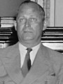
 Francis Gary Powers, pilot whose plane was shot down over the Soviet Union, causing the 1960 U-2 incident
.png)
.png)
.jpg)


.jpg)


List[edit]
- Kenny Baker (June 26, 1926 – July 8, 2011) was an American fiddle player best known for his 25-year tenure with Bill Monroe and his group The Blue Grass Boys.
- Martha Carson (Country/gospel music singer, 1920–2004)
- Harry M. Caudill (1922–1990), author, historian, professor, lawyer, legislator, and environmentalist
- Jean Chapel (Country music singer, 1925–1995)
- Hoover Dawahare (November 2, 1928 – March 16, 2004), former member of the Kentucky House of Representatives
- Jessamyn Duke (mixed-martial artist, professional wrestler)
- Emery L. Frazier (Mayor, state representative, Chief Clerk of the U.S. Senate, Secretary of the U.S. Senate, 1896–1973)
- Tom Gish, died 2008, publisher of the Mountain Eagle in Whitesburg, grew up in the county
- Jack K. Hale (1928–2009), mathematician
- Angie Hatton (born October 28, 1972), member of the Kentucky House of Representatives from 2017 to 2023.
- James P. Lewis (September 8, 1869 – May 22, 1942) former secretary of state of Kentucky from 1916 to 1920.
- Paul Mason (July 5, 1935 – December 7, 1998) was an American politician and activist who served in the Kentucky House of Representatives from the 91st district from 1987 until his death in 1998.
- Francis Gary Powers (August 17, 1929 – August 1, 1977) was an American pilot whose CIA U-2 spy plane was shot down while over the Soviet Union, causing the 1960 U-2 incident.
- Lee Sexton (Country, bluegrass, old-time musician)
- Gary Stewart (Country music singer and musician)
- Jim Webb (September 24, 1945 – October 22, 2018) was an Appalachian poet, playwright, and essayist.
- Sheila Wellstone (August 18, 1944 – October 25, 2002), politician and wife of U.S. senator from Minnesota Paul Wellstone.
See also[edit]
- Caudill, Harry M., Author of Night Comes to the Cumberlands (1963). ISBN 0-316-13212-8
- National Register of Historic Places listings in Letcher County, Kentucky
References[edit]
- ^ a b "State & County QuickFacts". United States Census Bureau. Retrieved September 8, 2022.
- ^ "Find a County". National Association of Counties. Archived from the original on May 31, 2011. Retrieved June 7, 2011.
- ^ "Populations of Kentucky (KY) Cities - Alphabetical Listing of Cities - page 2". Togetherweteach.com. Retrieved June 4, 2013.
- ^ a b Rennick, Robert (March 1, 2002). "Letcher County - Post Offices". County Histories of Kentucky.
- ^ "Letcher County". Kyenc.org. May 30, 1927. Archived from the original on September 4, 2015. Retrieved June 4, 2013.
- ^ The Register of the Kentucky State Historical Society, Volume 1. Kentucky State Historical Society. 1903. p. 36.
- ^ Collins, Lewis (1877). History of Kentucky. Library Reprints, Incorporated. p. 463. ISBN 9780722249208.
- ^ a b c d Rennick, Robert M. "Post Offices in Letcher County, Kentucky". Morehead State University.
- ^ a b c d e "The History of the Letcher County Courthouse". Kentucky Tennessee Living. December 26, 2021. Retrieved May 9, 2024.
- ^ "County History". Letcher County. Retrieved May 23, 2023.
- ^ a b c d "156 years of courthouses". usgenwebsites.org. Retrieved May 9, 2024.
- ^ a b "Census Records". National Archives. December 7, 2017. Retrieved May 7, 2024.
- ^ Adams, Sam; Gish, Ben (May 10, 2017). "How much coal has left Letcher? What's still here?". The Mountain Eagle. Archived from the original on March 4, 2021. Retrieved May 7, 2024.
- ^ "TV Review; Stark Poverty of One Million Americans". The New York Times. December 22, 1964. ISSN 0362-4331. Retrieved February 5, 2023.
- ^ Talbott, Tim. "Scotia Mine Disaster". ExploreKYHistory. Retrieved May 23, 2023.
- ^ "Scotia Mine Explosion". usminedisasters.miningquiz.com. Retrieved May 23, 2023.
- ^ "East Kentucky Flood". The Daily Yonder. April 14, 2023. Retrieved May 23, 2023.
- ^ "The flood of 2022". The Mountain Eagle. August 3, 2022. Retrieved May 23, 2023.
- ^ "Letcher" (PDF). Kentucky.gov. Retrieved May 8, 2024.
- ^ a b c d "Geographic Names Information System". edits.nationalmap.gov. Retrieved May 8, 2024.
- ^ "Groundwater Resources of Letcher County, Kentucky". www.uky.edu. Retrieved May 8, 2024.
- ^ "2010 Census Gazetteer Files". United States Census Bureau. August 22, 2012. Archived from the original on August 12, 2014. Retrieved August 17, 2014.
- ^ a b "Fisheries | KDFWR". app.fw.ky.gov. Retrieved May 8, 2024.
- ^ "Explore | Fish Pond Lake". Kentucky Tourism. Retrieved May 8, 2024.
- ^ "Fishpond Lake, Kentucky | Lake, Fishing & Travel Info". Lake-Link. Retrieved May 8, 2024.
- ^ a b c d e Mead, Andy (December 26, 2008). "Horse trail in trouble from start". Lexington Herald-Leader. Retrieved December 26, 2008.
- ^ "Annual Estimates of the Resident Population for Counties: April 1, 2020 to July 1, 2023". United States Census Bureau. Retrieved March 14, 2024.
- ^ "U.S. Decennial Census". United States Census Bureau. Retrieved August 17, 2014.
- ^ "Historical Census Browser". University of Virginia Library. Retrieved August 17, 2014.
- ^ "Population of Counties by Decennial Census: 1900 to 1990". United States Census Bureau. Retrieved August 17, 2014.
- ^ "Census 2000 PHC-T-4. Ranking Tables for Counties: 1990 and 2000" (PDF). United States Census Bureau. Archived (PDF) from the original on March 27, 2010. Retrieved August 17, 2014.
- ^ "LCPS Home". Archived from the original on January 15, 2010. Retrieved February 6, 2016. Letcher County Central High School
- ^ "Letcher County Central 2011 Kentucky High School Baseball". Scoreboard.12dt.com. Retrieved June 4, 2013.
- ^ "Kentucky High School Athletic Association". khsaa.org.
- ^ Jenkins Elementary School Archived August 24, 2007, at the Wayback Machine Retrieved on December 21, 2008.
- ^ "Presidential election of 1884 - Map by counties". geoelections.free.fr.
- ^ The Political Graveyard; Letcher County, Kentucky
- ^ https://elect.ky.gov/SiteCollectionDocuments/Election%20Results/2010-2019/2011/off2011gen.pdf
- ^ Leip, David. "Dave Leip's Atlas of U.S. Presidential Elections". uselectionatlas.org. Retrieved July 3, 2018.
- ^ [Alpha Natural Resources - 2012 Kentucky Operations]
- ^ "James River Coal Company – Blue Diamond complex".
- ^ "Rhino Resource Partners - Central Appalachia". Archived from the original on July 25, 2020. Retrieved June 20, 2013.
- ^ "METINVEST :: What we do :: Our facilities". ucc.metinvestholding.com.
- ^ Conroy, Marcus (July 4, 2010). "Local County Channel becoming popular". WYMT-TV. Archived from the original on July 7, 2010. Retrieved July 4, 2010.
- ^ "LCPS-TV Information". Letcher County Public Schools. Archived from the original on August 19, 2011. Retrieved July 4, 2010.
- ^ "LKLP Community Action Council, Inc. > Programs > Public Transportation". Retrieved May 19, 2015.
Further reading[edit]
- Blackford, Linda B. (December 14, 2013). "Schools improving in Eastern Kentucky, but progress 'painfully slow'". Lexington Herald-Leader.
External links[edit]
Municipalities and communities of Letcher County, Kentucky, United States | ||
|---|---|---|
| Cities |  | |
| CDPs | ||
| Unincorporated communities | ||
| Ghost towns | ||
| Counties | |
|---|---|
| Cities and towns Over 10k | |
| Cities and towns 5k-10k | |
| Cities and towns 1k-5k | |
| Cities and towns under 1k | |
| Statistical areas | |
| See also | |
37°07′N 82°51′W / 37.12°N 82.85°W
| International | |
|---|---|
| National | |
| Geographic | |
| Other | |