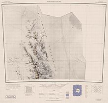
Helfert Nunatak


Helfert Nunatak (77°53′S 87°25′W / 77.883°S 87.417°W) is a prominent rock nunatak standing 15 nautical miles (28 km) west of Mount Sharp of the Sentinel Range, in the Ellsworth Mountains of Antarctica. It was discovered and visited by the Marie Byrd Land Traverse party, 1957–58, under Charles R. Bentley, and named for Norbert F. Helfert, a meteorologist at Byrd Station in 1957.[1]
References[edit]
- ^ "Helfert Nunatak". Geographic Names Information System. United States Geological Survey, United States Department of the Interior. Retrieved 9 June 2012.
![]() This article incorporates public domain material from "Helfert Nunatak". Geographic Names Information System. United States Geological Survey.
This article incorporates public domain material from "Helfert Nunatak". Geographic Names Information System. United States Geological Survey.
