Il-Lunzjata Valley
| Il-Lunzjata Valley | |
|---|---|
| Wied Il-Lunzjata | |
 The archway leading to the valley. | |
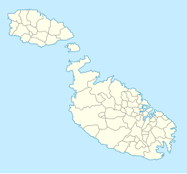
Lunzjata valley's location on a map of Malta | |
| Floor elevation | 197 ft (60 m) |
| Length | 0.4 km (0.25 mi) South |
| Width | 0.17 km (0.11 mi) West |
| Area | 0.1 km2 (0.039 sq mi) |
| Geography | |
| Location | Victoria, Gozo, Malta |
| Coordinates | 36°2′21″N 14°13′58″E / 36.03917°N 14.23278°E |
Il-Lunzjata Valley (Maltese: Wied Il-Lunzjata) is an agricultural valley located southwest of Victoria, Gozo. The valley is known for its lush fields and hospitaller-era chapel.[1] Running freshwater is very common on the valley bottom during autumn and spring.[2] This supply of freshwater is commonly put to use for the farming of crops in fields within the valley[3] through a number of channels dug on the ground.[4] The valley is also home to an old fountain that makes use of the freshwater which was restored in 2007.[5] Lunzjata is also considered a Natura 2000 site.[6]
References[edit]
- ^ "Il-Lunzjata Valley". VisitGozo. Retrieved 2021-11-21.
- ^ "Lunzjata Valley: discover Gozo's little-known rural haven". www.guidememalta.com. Retrieved 2021-11-21.
- ^ "Il-Wied tal-Lunzjata". Science Fieldwork In Gozo. Retrieved 2021-11-21.
- ^ Azzopardi, George (2020). "Vestiges of material culture at Il-Lunzjata valley and its immediate environs".
{{cite journal}}: Cite journal requires|journal=(help) - ^ "Lunzjata Fountain, Kercem, Gozo | Din l-Art Ħelwa - National Trust of Malta". 2011-10-06. Retrieved 2021-11-21.
- ^ "Lunzjata Valley Gozo". Barbarossa Excursions Gozo, Malta & Comino. 2020-11-30. Retrieved 2021-11-21.


