Brustury, Zakarpattia Oblast
Brustury
Брустури Brusztura | |
|---|---|
Village | |
 | |
| Coordinates: 48°21′49″N 23°57′59″E / 48.36361°N 23.96639°E | |
| Country | Ukraine |
| Oblast | Zakarpattia Oblast |
| Raion | Tiachiv Raion |
| Elevation | 599 m (1,965 ft) |
| Population (2001) | |
| • Total | 3,317 |
| Time zone | UTC+2 (EET) |
| • Summer (DST) | UTC+3 (EEST) |
 | |
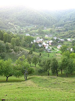
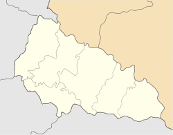
Brustury (Ukrainian: Брустури; Hungarian: Brusztura), known before 2023 as Lopukhiv (Ukrainian: Лопухів), is a village in Tiachiv Raion of Zakarpattia Oblast in Ukraine.
History[edit]
The village was first mentioned in 1638, when the village was called Brusztura. It comes from the Romanian word "brustur", meaning heart-shaped comfrey. [citation needed]
After it was incorporated into the Ukrainian SSR as part of the Ukrainianization of the Carpathians, the village was renamed Lopukhiv.[citation needed]
On June 29, 2023, the Verkhovna Rada officially renamed the village to Brustury as part of the derussification in Ukraine.[1]
Geography[edit]
Brustury is located on both sides of the river Brusturyanka, 67 km (42 mi) from the district center Tiachiv.[2]
Demographics[edit]
Native language as of the Ukrainian Census of 2001:[3]
- Ukrainian 99.64%
- Others 0.36%
References[edit]
- ^ "Про перейменування села Лопухів Тячівського району Закарпатської області". Verkhovna Rada (in Ukrainian). Retrieved 2023-11-02.
- ^ Бєлоусов, В.І. (1969). Історія міст і сіл Української РСР (in Ukrainian). Кyiv: Головна редакція української радянської енциклопедії АН УРСР. p. 646.
- ^ Розподіл населення за рідною мовою на ukrcensus.gov.ua Archived 31 July 2014 at the Wayback Machine


