Sząbruk
Sząbruk | |
|---|---|
Village | |
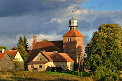
 Saints Nicholas and John the Evangelist church in Sząbruk | |
| Coordinates: 53°43′27″N 20°20′6″E / 53.72417°N 20.33500°E | |
| Country | |
| Voivodeship | |
| County | Olsztyn |
| Gmina | Gietrzwałd |
| Population | |
| • Total | 970 |
Sząbruk [ˈʂɔmbruk] is a village in the administrative district of Gmina Gietrzwałd, within Olsztyn County, Warmian-Masurian Voivodeship, in northern Poland.[1] It lies approximately 8 kilometres (5 mi) east of Gietrzwałd and 13 km (8 mi) south-west of the regional capital Olsztyn.
References[edit]

