
Kampalapura

Kampalapura is a village in Mysore district of Karnataka state in India.
Location[edit]
Kampalapura is located between Mysuru and Madikeri cities at latitude 12.335401 and longitude 76.158353. It is also sometimes referred to as Kamplapura. [1] 12°20′07″N 76°09′30″E / 12.335401°N 76.158353°E
Villages and suburbs[edit]
Periyapatna. 7 km Kushalnagar 28 km Bettadapura 22 km Ramanathapura 40 km Saligrama 38.5 km Hunasuru 16 km Gonikoppa 34 km Virajpete 50 km [2]
Demographics[edit]
The population of Kampalapura village is 4,721, and there were 1,112 families identified in the last census.[3]
Economy[edit]
The economy of the village is mostly agrarian. The major crops are tobacco, ragi, maize, areca nut and rice.
Educational organisations[edit]
- Government Primary School, Kamplapura.
- Government Urdu Primary School,
- Government High School,
- Sri Naga vidya sametha.
- MR Noble English medium school.
Post office[edit]
There is a post office in the village and the pin-code is 571107.
Image gallery[edit]
-
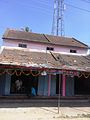 Old building in Kampalapura
 -
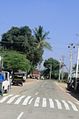 Kampalapura village

