
Prasadpur
This article has multiple issues. Please help improve it or discuss these issues on the talk page. (Learn how and when to remove these template messages)
|
Prasadpur (official name " Prosadpur ") is a village in Haripal (community development block) in Chandannagore subdivision of Hooghly district in West Bengal, India.
Prasadpur
Prosadpur | |
|---|---|
Village | |
 Prasadpur Location of the village  Prasadpur Prasadpur (India) | |
| Coordinates: 22°47′34″N 88°09′08″E / 22.79278°N 88.15222°E | |
| Country | |
| State | West Bengal |
| District | Hooghly |
| Government | |
| • Type | Panchayati Raj(India) |
| • Body | Panchayet |
| Population (2011) | |
| • Total | 1,019 |
| Language | |
| • Official | Bangla (বাংলা), English |
| • Mother tongue | Bengali |
| • Dialect | Rarhi (রাঢ়ী) |
| Time zone | UTC+5.30 (IST) |
| Pin | 712707 |
| ISO 3166 code | IN-WB |
| Vehicle registration | WB |
| Website | wb |
Location[edit]
Prasadpur is located at 22°47′N 88°09′E / 22.783°N 88.150°E. It is situated between Jagatballavpur and Jangipara.[1]
Transport[edit]
Prasadpur is 2.5 km apart from Ahilyabai Holkar Road (State Highway 15). Roads of the village are mainly made with red mud.
Bus[edit]
Private Bus[edit]
Bus Route Without Number[edit]
Train[edit]
Nearest railway station is Bargachia railway station on Howrah-Amta line. It is nearly 10 km away from Prasadpur.
Demographics[edit]
Ratio of population
According to 2011 Census of India total population was 1019,[2] where male population was 488 (47.89%) and female population was 531 (52.11%) among them 652 (63.89%) were literate (Male:315, Female:337). 137 were in age group 0-6 yrs.
Education[edit]
A Primary School is situated nearly middle of the village which is established in 1969. There is no high school there.
Cultural and religious views[edit]
People of Prosadpur practices mainly Islam and Hinduism. There is a Mosque , an Eidgah and two Temple in here. Prasadpur is famous for Baba Panchananda Temple. (বাবা পঞ্চানন্দ মন্দির)।
Main festivals is Eid and Durga Puja.
Males mainly wear Panjabi, pajamas, Shirt , Dhuti, Lungi and Trousers and females are wear Sari, Churidar and Shalwar kameez.
Economy[edit]
Agriculture is the main economic backbone. Irrigation system are moderate. A DVC Canal is present which carries water for agriculture from rever Damodar. Groundwater also is used in irrigation purpose.[citation needed]
Produced crop[edit]
Produced vegetable[edit]
- Rubbed Gourd
- Long Bean
- Drumstick
- Palwal or Potol
- Brinjal
- Tomato
- Chicinga or Hopa
- Spinach
- Cabbage
- Cucumber
- Cauliflower
- onion
- Okra
No small or big industries are here.
Gallery[edit]
-
 Prasadpur Masjeed
 -
 Red mud road of village
 -
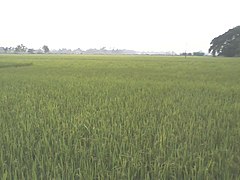 Rice field


References[edit]
- ^ "Google Maps". Google Maps. Retrieved 31 July 2019.
- ^ "Census of India Website : Office of the Registrar General & Census Commissioner, India". censusindia.gov.in. Retrieved 31 July 2019.