
Borówno, Lower Silesian Voivodeship
Borówno | |
|---|---|
Village | |
 Church in Borówno | |
 Borówno | |
| Coordinates: 50°46′35″N 16°05′56″E / 50.77639°N 16.09889°E | |
| Country | |
| Voivodeship | Lower Silesian |
| County | Wałbrzych |
| Gmina | Czarny Bór |
| Elevation | 450 m (1,480 ft) |
| Population | 650 |
Borówno [bɔˈruvnɔ] is a village in the administrative district of Gmina Czarny Bór, within Wałbrzych County, Lower Silesian Voivodeship, in south-western Poland.[1]
It lies approximately 3 kilometres (2 mi) north-west of Czarny Bór, 14 kilometres (9 mi) west of Wałbrzych, and 77 kilometres (48 mi) south-west of the regional capital Wrocław.
Settlement of Polish Highlanders from Podhale[edit]
Whereas most of the former German and Czech settlements of Lower Silesia and the County of Kladsko were repopulated by Poles from regions east of the Curzon line and from war-devastated central Poland after World War II, Borówno and neighboring Czarny Bór were settled by a group of Górals. These Polish Highlanders from the Podhale region created a new home in this area as well as in the nearby village of Krajanów. While the new inhabitants initially cultivated their unique customs and folklore, these traditions have disappeared over time, although recently there have been efforts towards a cultural revival.[2]
Gallery[edit]
-
 Avenue
 -
 Playground
 -
 Countryside
 -
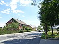 Houses by road


.jpg)
References[edit]
- ^ "Central Statistical Office (GUS) - TERYT (National Register of Territorial Land Apportionment Journal)" (in Polish). 2008-06-01.
- ^ Maciejewski, Marian. "Wiedzieliście, że na Dolnym Śląsku mamy prawdziwych górali?". No. October 15, 2020. Agora. Gazeta Wyborcza. Retrieved 1 May 2020.
| Seat |  | |
|---|---|---|
| Other villages | ||
This Wałbrzych County location article is a stub. You can help Wikipedia by expanding it. |