
Lekartów
Lekartów | |
|---|---|
Small town | |
 Street | |
 Lekartów | |
| Coordinates: 50°4′N 18°8′E / 50.067°N 18.133°E | |
| Country | |
| Voivodeship | Silesian |
| County | Racibórz |
| Gmina | Pietrowice Wielkie |
| Population | 280 |
Lekartów [lɛˈkartuf] is a village in the administrative district of Gmina Pietrowice Wielkie, within Racibórz County, Silesian Voivodeship, in southern Poland, close to the Czech border.[1] It lies approximately 5 kilometres (3 mi) south-east of Pietrowice Wielkie, 8 km (5 mi) west of Racibórz, and 66 km (41 mi) west of the regional capital Katowice.
Gallery[edit]
-
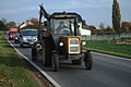 Tractor and his driver
 -
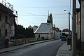 Village chapell
 -
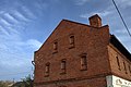 Brick house


References[edit]
Wikimedia Commons has media related to Lekartów.
| Seat |  | |
|---|---|---|
| Other villages | ||
This Racibórz County location article is a stub. You can help Wikipedia by expanding it. |